In the 19th century, an English geologist named Middlemiss surveyed Nainital. He remarked that identifying the sensitive areas of Nainital would invite a barrage of curses because the soil was shifting then, and it is still shifting now. The problem was lesser back then, but it has significantly increased now...
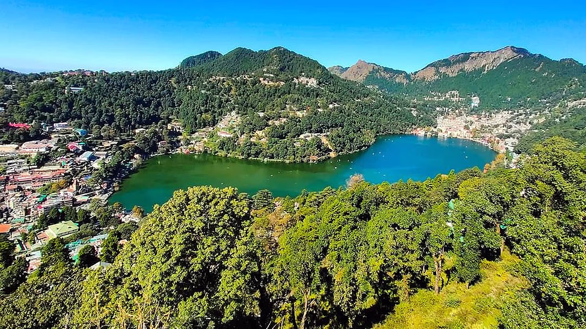
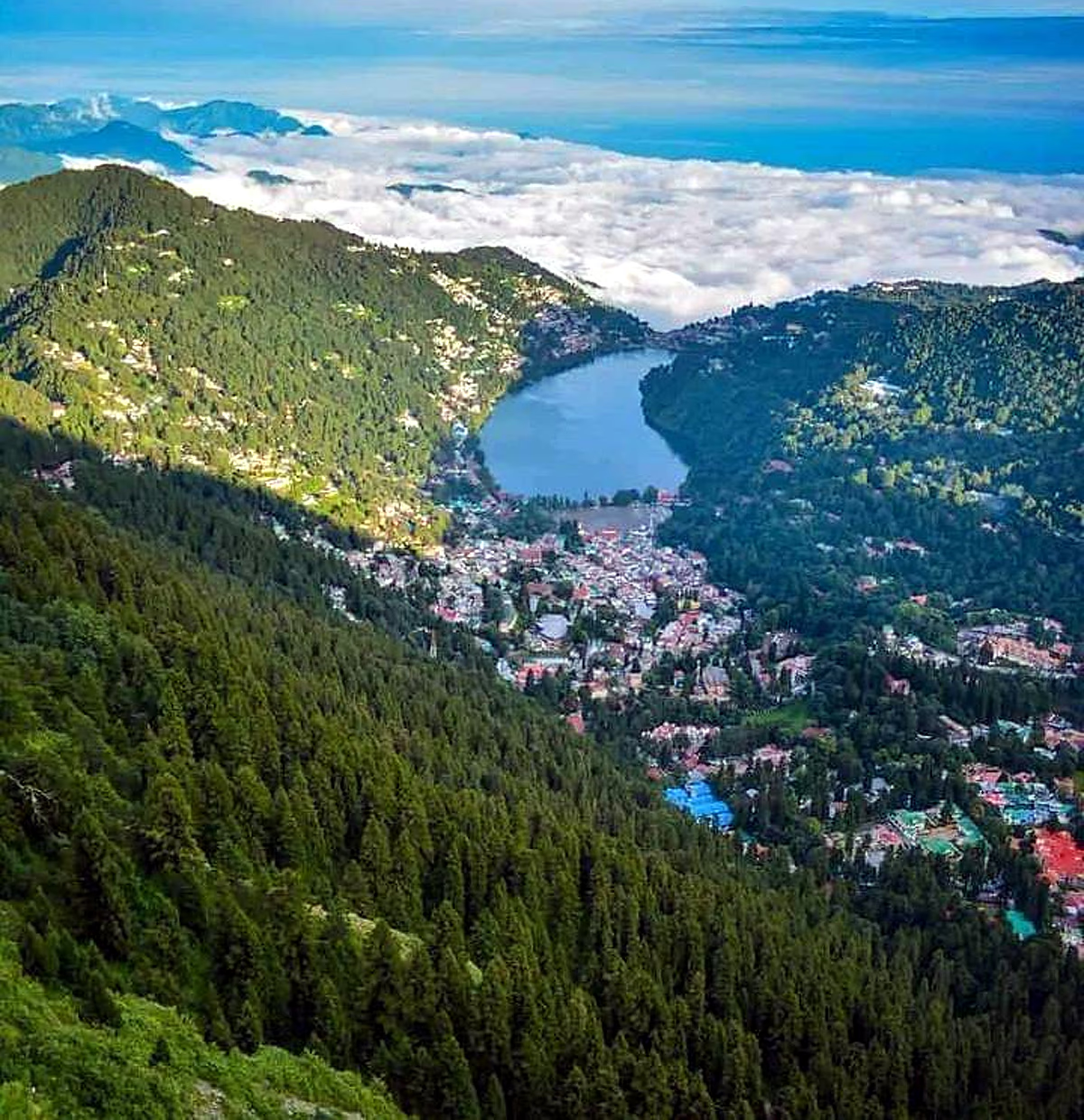
Nainital is surrounded by hills on three sides. To the north lies Naina Peak, on one side Ayarpatta Hill, and on the other, Sher-ka-Danda Ridge. Below, Balianala forms the foundation of the city. Currently, landslides are occurring not only in Balianala but also in these surrounding hills. This is a troubling sign for Nainital. Geologists suggest that Nainital's capacity to bear weight has been exhausted. Unless all construction activity is halted, the city will sink.
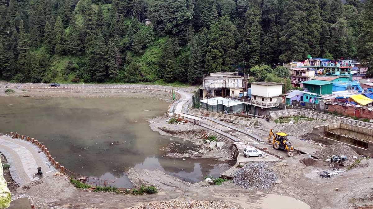
Since 1972, landslides have been ceaselessly occurring in the Balianala area. Despite this, the government has been unsuccessful in preventing landslides in this crucial region of Nainital's foundation. The situation has only worsened over the years, and a scientific solution has yet to be implemented. If the foundation gives way, the entire city of Nainital will collapse.
Many homes have already slipped into Balianala due to landslides. The subsidence has now reached the boundary of the government-run Inter College of Tallital, spreading into populated areas and moving towards Nainital. The first recorded landslide in Balianala took place in 1867.
Geologically, Balianala originates near Alu Khet, below Kaila Khan, and extends to Bir Bhatti. The rocks in this area are primarily limestone, leading to the formation of water-eroded caves that release a yellowish hue, known as oxidation-reduction. The old Balianala shifts about 60 centimeters to a meter each year, and the day it fully collapses will be catastrophic for Nainital.
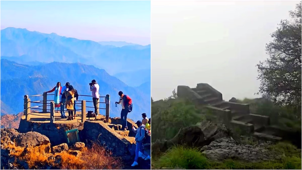
Landslides near DSB College on the Ayarpatta Hill are rapidly escalating, causing significant damage to the KP and SR women's hostels. The fault line near the college is primarily responsible for this major landslide, which has affected areas from the Governor's House to Flat Grand Hotel and Seven Number. In the past two to three years, Mall Road has begun to sink as well. The famous picnic spot Tiffin Top also recently succumbed to a landslide, vanishing completely.
Landslides have now started from Nainapeak, also known as China Peak, with massive boulders periodically falling, posing a threat to the population below.
The sensitive Alma Hill, which saw a devastating landslide in 1880, started experiencing landslides again last year.
On October 18, 2021, heavy rain caused a significant landslide on Sher-ka-Danda Ridge at 1 a.m., bringing down large boulders and trees. This landslide buried the homes of four families, who narrowly escaped with their lives.
The measures taken by the British to prevent landslides in the hills can still be effective today, provided they are properly implemented and rules strictly enforced. Landslide disaster management in India began in Nainital. The first settlement in the town was established in 1841, and on September 18, 1880, a major landslide killed 151 people following 838 mm of rainfall in 40 hours.
Source: aajtak
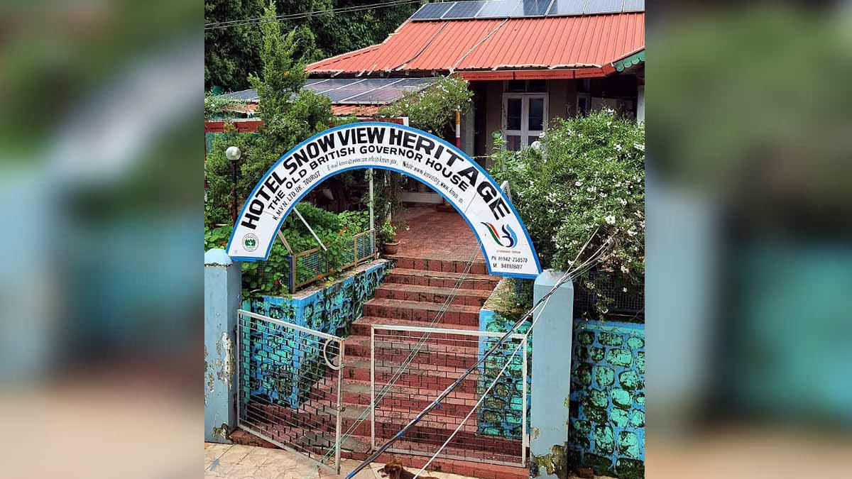
The Nayana Devi Temple was also affected, leading to the formation of the Flats ground. The disaster prompted the construction of a new Governor's House, initially located on Sher-ka-Danda Ridge and later moved to Snow View Heritage on Alma Hill.
Landslides were reported earlier in 1867 when a massive rock fell from Charlton Lodge, fortunately without causing significant damage. Post this event, a Hillside Safety Committee was formed by the British, and their recommendations were promptly implemented.
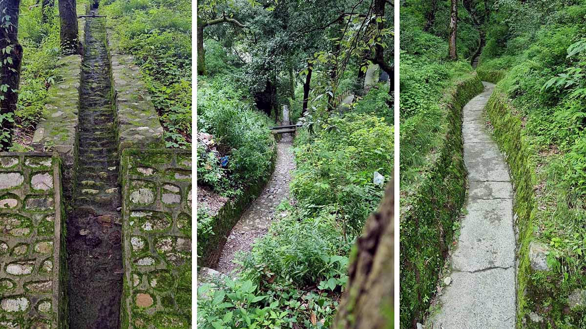
Sir Henry Ramsay, the Commissioner from 1856 to 1884, consulted senior geologist Dr. Middlemiss from GSI, who recommended 60 drains for a permanent solution to landslides. They managed the water flow around Nainital's hills, building 79 km of drains, which effectively help prevent landslides till this day.
Source: aajtak
Encroachment over these drains was strictly prohibited. Back then, only beautiful cottages existed in Nainital, each with a tennis court. The Hillside Safety Committee suggested turfing all tennis courts and ensuring proper drainage underneath.
The British planted five species of oak (Baanj, Ringaal, Phalyat, Tilonj, Kharsu) across Nainital to Kilberi. These forests play a crucial role in enriching the environment. Oak roots absorb and retain rainwater, contributing to the flow in water sources. The vast network of oak roots holds the soil together, preventing erosion.
The British categorized Nainital into three zones: Safe, Unsafe, and Prohibited. Construction was allowed in the Safe Zone, minor construction at one's own risk in the Unsafe Zone, with no government liability for natural disaster damage. The Prohibited Zone had a total ban on construction. Currently, 90% of Nainital's construction is in the Prohibited Zone, and 10% in the Unsafe Zone.
Safe Zone...
Major Market Area of Nainital, Rickshaw Stand Area in Tallital, St. Joseph College, District Court, and Collectorate.
Unsafe Zone...
Below Naina Peak Hill, Mel Rose Compound, above Degree College on Ayarpatta Hill, Long View Area in Tallital, Gufa Mahadev, and Kishanapur.
Prohibited Zone...
Alma Hill where the 1880 landslide occurred, Sher-ka-Danda Ridge, above Balianala at Rais Hotel, Manora Peak, and Hanumangarhi Temple.
Source: aajtak
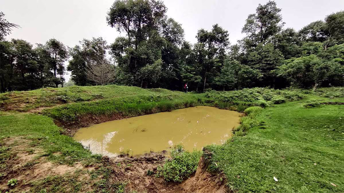
The British constructed 'Chal' and 'Khal' structures for water management. Water bodies were created around Nainital to store rainwater, which subsequently percolated into Naini Lake, ensuring it never dried up.
Geologists explain that the British, after conducting surveys for disaster management, constructed drains. Now many of those drains are not visible due to encroachment. However, during heavy rains, water does not overflow but directly infiltrates into the lake.
Fissures and lime-soil caves in Nainital's hills were filled with fine clay by the British. Many sites like Seven Number Hill and behind Kumaon University have large cracks that need attention to prevent landslides.
Source: aajtak
The British prohibited construction in and around natural wetlands which supply water to Naini Lake throughout the year. The primary wetland, Sukhtal Lake, remains filled during monsoons and supplies water to Naini Lake all year round.
Today, encroachment on these wetlands is rampant. Construction in these areas is strictly prohibited, yet it persists, threatening the lake's water supply.
High-Rise Buildings Should Be Demolished; Group Housing Should Be Stopped: Dr. Rawat
Dr. Ajay Rawat, a historian and environmentalist, states that the Supreme Court has banned the construction of multi-storey buildings in Nainital. Group housing is also prohibited, yet construction continues in violation of these orders. These multi-storey buildings must be demolished.
Source: aajtak
Padma Shri Anoop Shah reveals that the Department of Forests wasted funds by digging up a beautiful meadow near Tiffin Top to create 'Chal and Khal' structures. Natural grass absorbs water efficiently, and the meadow, once surrounded by cedar trees, was a popular picnic spot.
Geologist Abhishek Mehra from Kumaon University explains that Nainital is situated on the geological structure of the Himalayan foothills, comprising complex stratified hills. The slate and dolomite that form these hills make them highly sensitive and prone to landslides. Major examples include the Balianala Fault and the sections of Sherwood Hill composed of dolomite.
Source: aajtak
Dr. Girish Ranjan Tiwari of Kumaon University's Journalism Department highlights that unregulated constructions and improper drainage management are exacerbating the risks of landslides. The once-stable regions like Lower Mall Road, Ayarpatta Hill near Pasaan Devi Temple, and Tiffin Top are now seeing landslides.