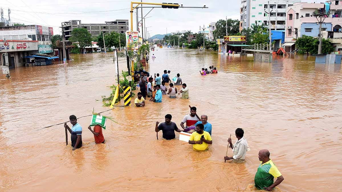
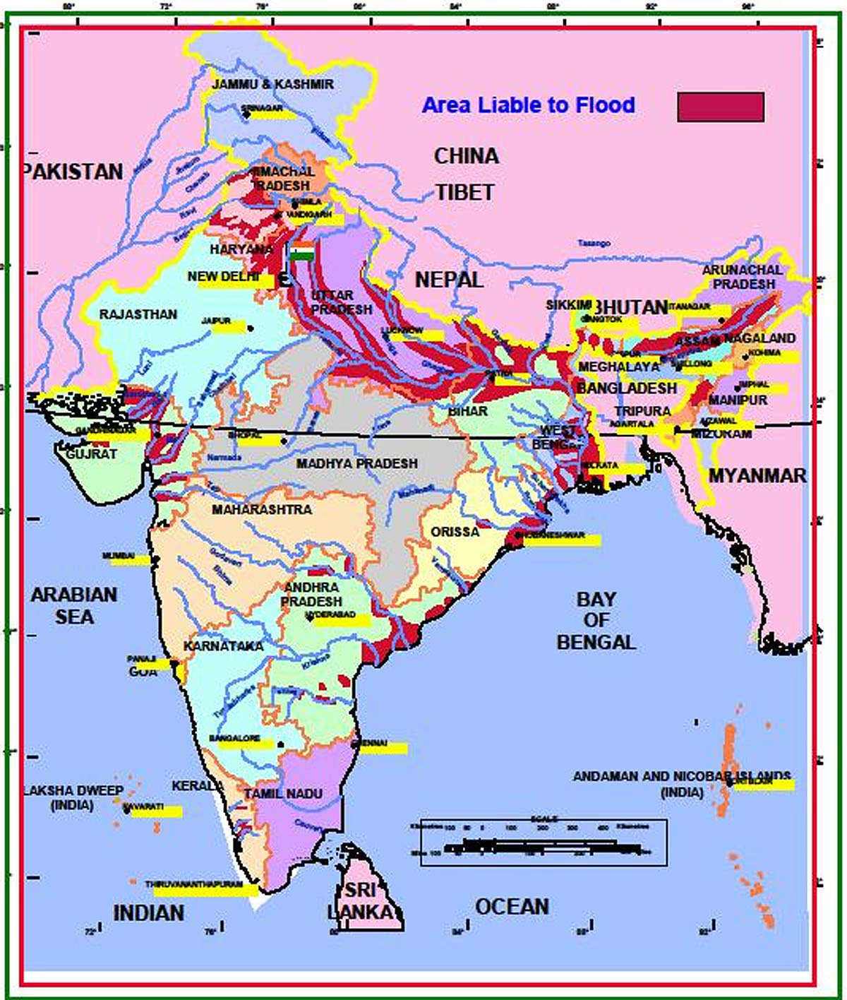
The recent heavy rains in Rajasthan, Gujarat, Maharashtra, Andhra Pradesh, and Telangana have made it clear that India's flood map is changing. Previously, only states like UP, Bihar, and North-Eastern states were considered at high risk for floods. Now, the boundaries of 'urban floods' are expanding, making it imperative for the government to create a new flood map.
The entire country's monsoon pattern has shifted. This year's monsoon is expected to linger longer than usual, influenced by cyclones, depressions, and low-pressure areas forming over the Bay of Bengal and the Arabian Sea. A new storm pattern has emerged where storms form over land, move to the sea, and gain strength.
Also Read:
Source: aajtak
Regions that used to be known for droughts are now experiencing intense rainfall and severe flooding. This transformation is evident across the country. According to the National Disaster Management Authority (NDMA), the most flood-prone areas include the Ganga-Brahmaputra basin, spanning from Himachal Pradesh to Punjab, Uttar Pradesh, Bihar, Assam, and Arunachal Pradesh. Coastal areas like Odisha, Gujarat, Andhra Pradesh, and parts of Telangana are also experiencing frequent floods.
Where Droughts Once Ruled, Floods Now Prevail
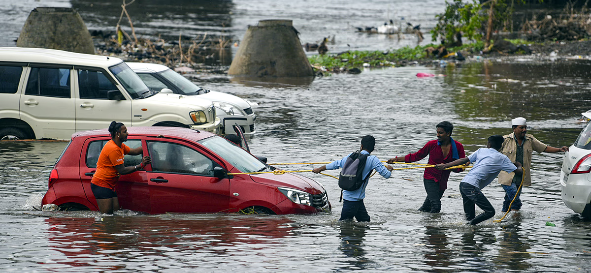
A report by IPE Global and ESRI-India reveals that rainfall intensity and volume have increased in 80% of Gujarat's districts over the past two decades. This year's floods in the Saurashtra region highlight this change. Previously, 110 districts in the country shifted from drought-prone to flood-prone. Now, 149 districts suffer more from floods than droughts.
Also Read:
Source: aajtak
Bihar, Andhra Pradesh, Odisha, Gujarat, Rajasthan, Uttarakhand, Himachal Pradesh, Maharashtra, Uttar Pradesh, and Assam's 60% districts now face extreme weather events annually. By 2036, these disasters will impact over 1.47 billion people in India.
Unpredictable and Extreme Weather Conditions
A new report studying extreme weather events from 1973 to 2023 shows unpredictable occurrences. Floods in Delhi, Gujarat, and Telangana, landslides in Wayanad, or devastating heatwaves create challenges even for scientists and experts due to the sudden escalation in intensity. Assam's 90%, Bihar's 87%, Odisha's 75%, and Andhra Pradesh and Telangana's 93% districts are susceptible to extreme floods at any time.
Also Read:

Source: aajtak
Chief scientist Abhinash Mohanty, who conducted the study, explained that heat is now transferring from land to the sea, as observed in Gujarat, Andhra Pradesh, and Telangana, resulting in increased sea temperatures. This impacts weather patterns, causing areas like Srikakulam, Cuttack, Guntur in South India, and West Champaran in Bihar, known for floods, to experience drought.
Visible Signs of Changing Weather... and More
The impacts of changing weather are visibly clear. Landslides in Wayanad, floods in Gujarat after intense rain, the disappearance of snow from Uttarakhand's Om Parvat, and sudden weather changes resulting in urban flooding. This year's monsoon started weak in June but grew stronger by September in both intensity and volume.
What’s alarming is that monsoon seasons used to bring cooler weather, but this year, the heat remains unabated. The number of dry and hot days in Eastern states is rising. Former meteorologist Anand Sharma states that climate change and rising temperatures are critical reasons behind these weather changes. It is crucial to mitigate these changes to prevent extreme weather events from becoming more frequent and severe.
