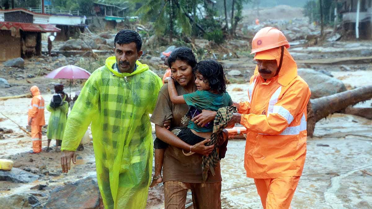
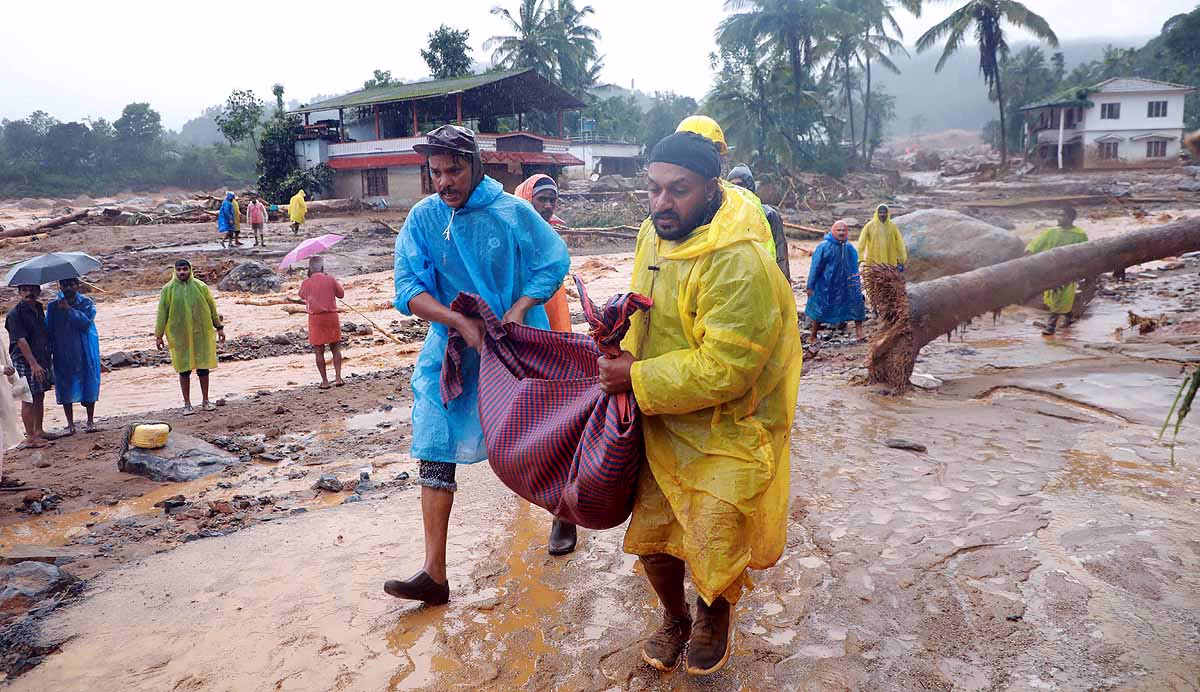
Urul Pottal... That’s how landslides are referred to in Malayalam. Dozens of bodies have been retrieved from beneath the earth. Many more are suspected to be buried. Mundakki, Churalmala, Attamala, and Noolpuzha villages are the hardest hit. Wayanad isn't the only district facing Urul Pottal. Districts like Kottayam and Idukki are also plagued by this issue. But Wayanad is Kerala's unique plateau area – a terrain of uneven mounds of soil, rocks, and vegetation.
According to a 2021 Study by the Geological Survey of India, 43% of Kerala's total area is susceptible to landslides. 74% of Idukki and 51% of Wayanad consist of steep slopes, making landslides highly probable. Add to that the torrential monsoon rains. Who can forget the floods of 2019 and 2020?
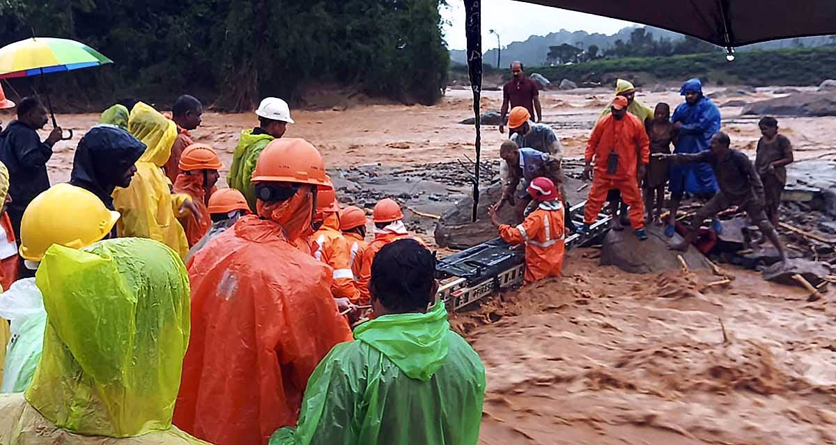
Live Updates on Wayanad Landslides
Source: aajtak
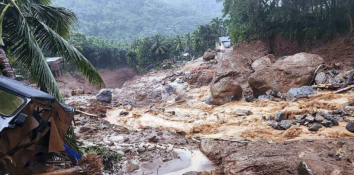
In Kerala's 1848 square kilometers, the Western Ghats host the most sloping terrains; mainly Wayanad, Kozhikode, Malappuram, Idukki, Kottayam, and Pathanamthitta districts. These districts witness the highest number of landslides. In 2019, within three days, Kerala experienced 80 landslides across 8 districts, killing 120 people. In 2018, 341 major landslides occurred across ten districts. Idukki alone saw 143 landslides, resulting in 104 deaths.
Rainfall in various regions of Wayanad over the past 24 hours:
Vyathiri:
28 cm (280 mm/11 inches)
Mananthavady:
20 cm (200 mm/7.87 inches)
Karappuzha:
14 cm (140 mm/5.51 inches)
Also Read: Paris Olympics 2024 Heatwave Threat: Severe Heatwave Danger, Medal Races May Be Deadly
In the past, such incidents were less frequent in Kerala. However, over the years, they have increased rapidly. For instance, in 2019, Kurichiamala in Wayanad received 4000 millimeters of rain, whereas the average rainfall over a decade was only 2200 millimeters. The threat of heavy rainfall is ever-present.
Source: aajtak
Why Are There So Many Landslides?
Deforestation...
Kerala has been known for its tea plantations for over 100 years. However, with fewer plant species and rapid deforestation, forests have decreased significantly. Climatic changes have altered rainfall patterns, leading to increased landslides in hilly areas.
Geographical Location...
This district is set on the slopes of the Western Ghats Plateau, with steep gradients, valleys, and hills, making it prone to landslides.
Also Read: Cloudbursts to Flash Floods: Increasing Weather Fury... Will the Himalayas Suffer More Aerial Blows?
Heavy Rainfall...
During the monsoon season, Wayanad often endures over 2000 millimeters of rainfall. This saturation makes the soil prone to erosion, leading to landslides.
Soil Quality...
Most of Wayanad has laterite soil, which is weak and erodible. When saturated with rainwater, it gets heavier and loses strength, leading to landslides.
Source: aajtak
Land Use Changes A Major Issue
About a decade ago, the National Centre for Earth Studies mapped out a hazard zone. Safe areas back then are now hazardous. In 2018-19, 41% of the landslides in Vyathiri, Wayanad, occurred around houses built on slopes. Another 29% happened along roadsides, 17% near commercial areas, and 10% in vegetative zones. Only 3% occurred in forests. Thus, changes in land use significantly increase the risk of such natural calamities. Unplanned development under the guise of infrastructure leads to these disasters.
Also Read: Climate Change: Changing Rain Patterns, Northward Shift Expected for the Next 20 Years
What Is Wayanad’s Geographical Terrain Like?
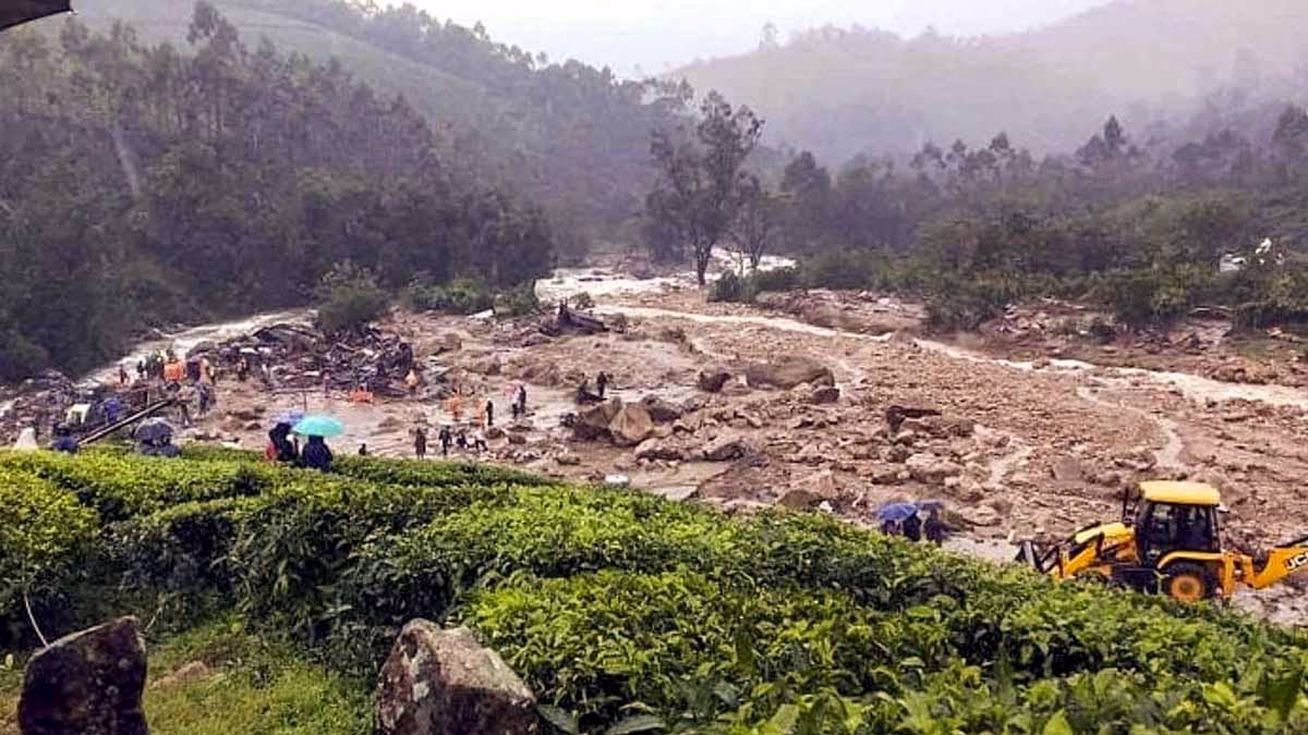
This plateau area stands at an elevation of 2695 meters or 8841 feet. 40% of Kerala is covered by the Western Ghats – a humid, dense, rainforest area. Landslides are almost certain with even a brief period of rain. Wayanad is situated in the midst of this landscape, covering 2130 square kilometers. Geographically, Wayanad is divided into four parts.
Source: aajtak
Peninsular Gneissic Complex, Migmatite Complex, Charnockite Group, and the Wayanad Group. The stones of the Wayanad Group are in the northern region, the Charnockite in the south and southeast. This is essentially a geological-chemical method of understanding soil and stone. The district sits at an elevation of 2084 meters.
Most of the district's water comes from the Kabani River and its branches. Flooding in the plains is natural due to the surrounding hills. The district's eastern part ranges from 1000 to 1400 meters high and mostly consists of clay-like soil – weak and prone to sliding, increasing the risk of landslides.
Wayanad's Largest Landslide to Date
A landslide in Kurichiamala, Wayanad once caused 150 acres of land to collapse, including 130 acres of tea plantations and 20 acres of farmland. Seventeen families lost their homes. In 2020, Mundakki endured continuous rainfall for three days, totaling 900 millimeters. The administration successfully evacuated residents, and a major landslide occurred the day after the rain ceased.