Cyclone Montha, emerging from the Bay of Bengal, and Hurricane Melissa from the Atlantic Ocean in 2025, are formidable sea storms known to bring fierce winds, torrential rains, and flooding. Though they share a common nature, differences like naming conventions, origin, and power separate them.
Cyclone is a massive rotating storm formed from warm ocean water, where winds can exceed 63 km/h. Such systems develop in the Northern Indian Ocean, including the Bay of Bengal. Hurricanes are similar but originate in the Atlantic Ocean or eastern Pacific.
Read More:
Main Difference: Regional names distinguish them - 'Cyclone' in India/Bay, 'Hurricane' in the US/Atlantic.
The scales to measure them differ slightly: Cyclones use the 'Verikel' (V1 to V5), Hurricanes use the 'Saffir-Simpson Scale' (Cat 1 to Cat 5). Both cause similar havoc - winds, floods, and sea surges.
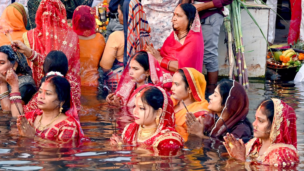
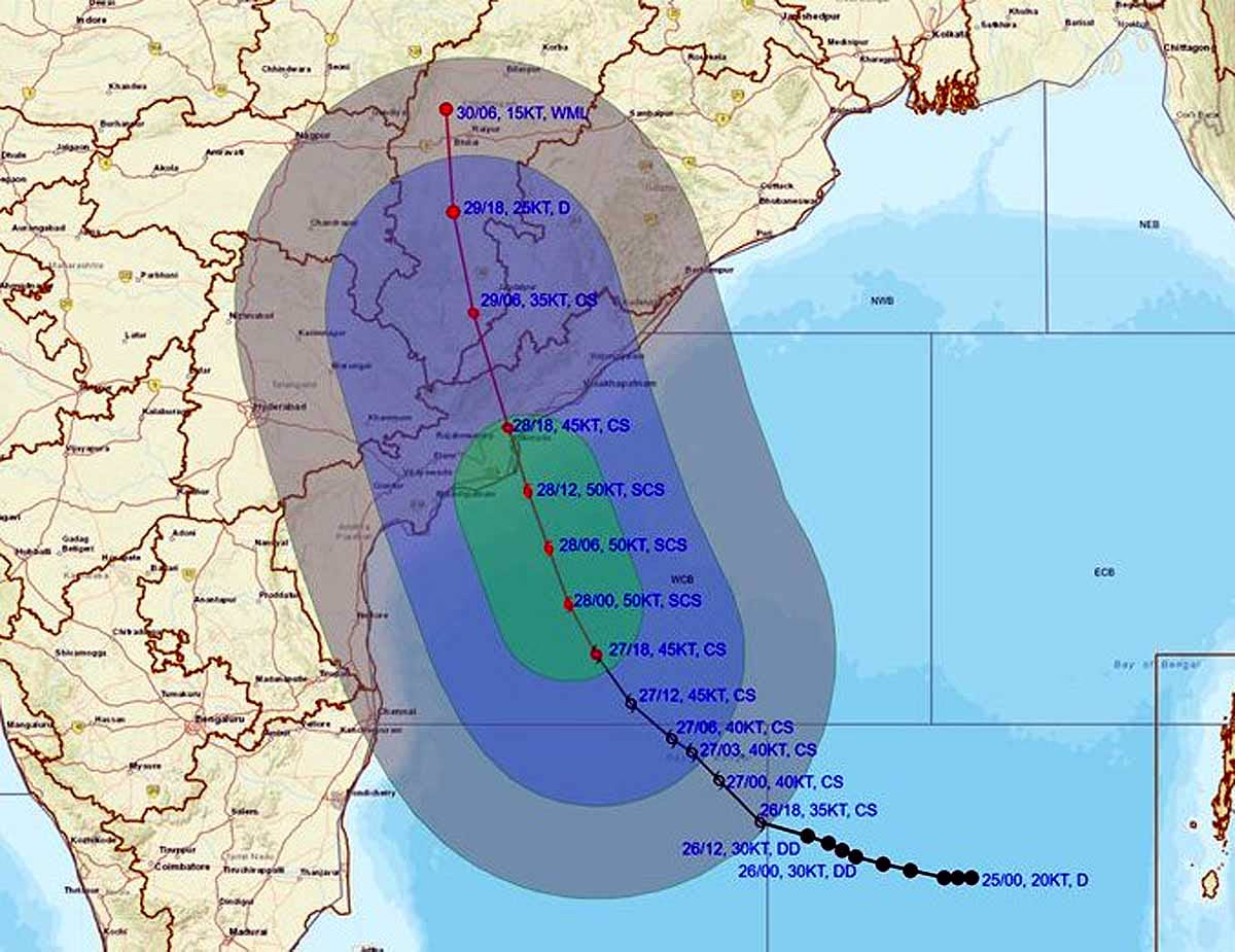
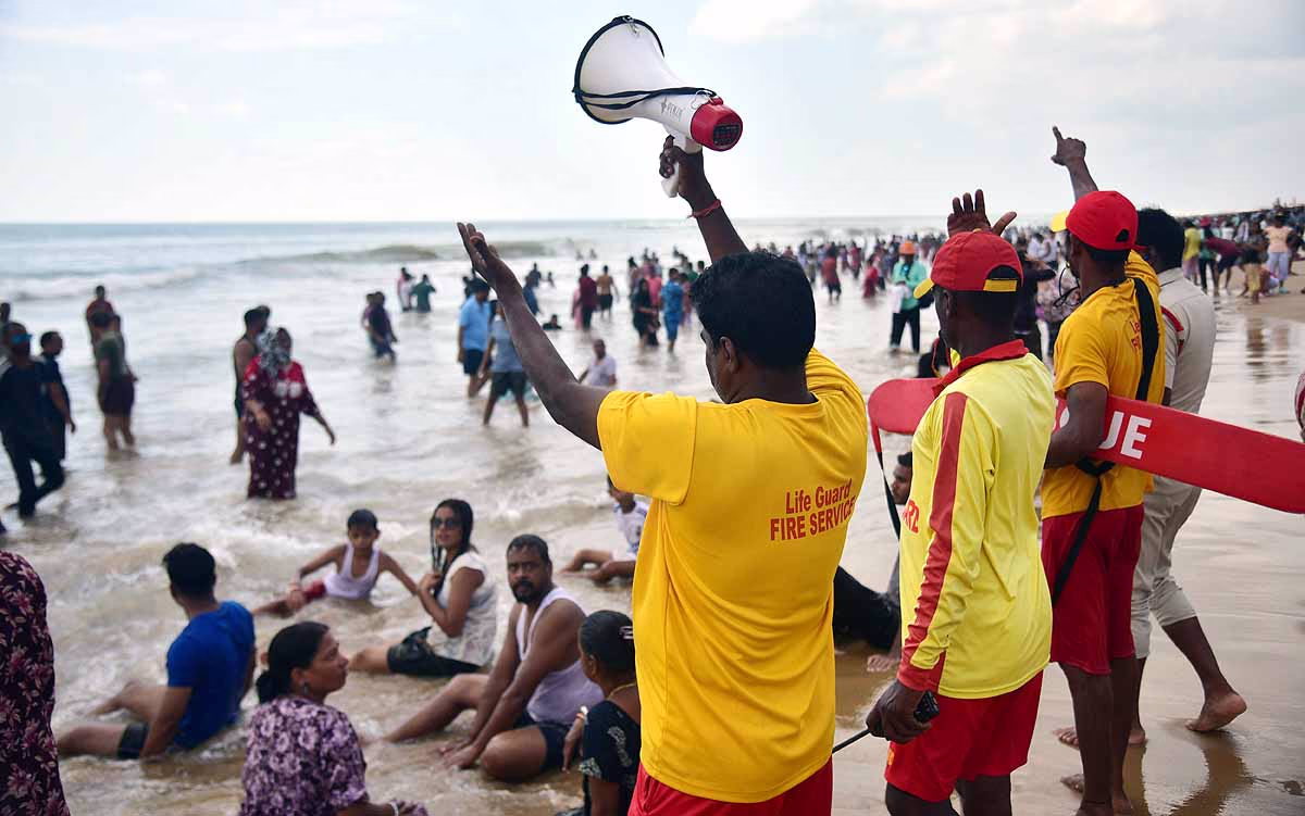
Cyclone Montha formed in late October 2025 within the southeast section of the Bay of Bengal. Driven by a low-pressure area over warm waters (28-30°C) and moist air, it evolved into a cyclonic storm, heading towards Andhra Pradesh; expected to hit near Kakinada on 28th October.
Distinguishing it from hurricanes, Montha was monitored by India's IMD, while hurricanes like Melissa are tracked by the US National Hurricane Center (NHC). Montha stayed in the Bay of Bengal, while hurricanes often originate off the African coast.
Source: aajtak
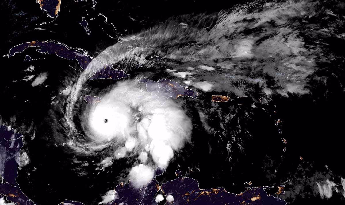
Hurricane Melissa is the fifth storm of the 2025 Atlantic hurricane season, formed from a 'tropical wave' near West Africa in early October. Rapidly intensifying by October 25-26, it reached Category 5, set to strike Jamaica on October 29 with winds at 282 km/h.
Compared to cyclones, Melissa traveled across the ocean from Africa, featuring a distinct 'eye', the storm's calm center.
Read More:
Naming plays a crucial role in recognizing and issuing warnings for storms. In the Indian Ocean, the World Meteorological Organization (WMO) gets name suggestions from 13 countries like India, Thailand, and Bangladesh, opting for short, easy, culturally relevant names.
For hurricanes in the Atlantic, WMO's Hurricane Committee prepares a list every 6 years, alternating between male and female names. Names of notably destructive storms (e.g., Katrina) are retired.
Difference: Cyclone names are linked to countries (e.g., Montha from Thailand), whereas hurricane names like Melissa are more general.
Source: aajtak
The name Montha was proposed by Thailand, bearing cultural significance as it means fragrant or beautiful flower. Named when storm winds hit 62 km/h, its impact may lead to possible retirement if significant damage occurs.
Difference from hurricanes: Montha's name has cultural ties, while Melissa is common and lacks a specific story.
Read More:
Melissa, 2025's 13th name on the Atlantic list (succeeding Marco, Nana, Omar), cycles through WMO's 6-year repetition, having been a less impactful storm in 2019. If of catastrophic impact in 2025, it's likely to be retired. Names are chosen for easy pronunciation.
Contrast to cyclones: Hurricane names are cycled, cyclone names are freshly suggested by countries. Melissa followed male names; cyclones have no fixed gender pattern.
Source: aajtak
Montha's peak power classifies it as a Severe Cyclonic Storm, with winds of 90-100 km/h, gusting to 110 km/h. It will impact near Kakinada on October 28, 2025.
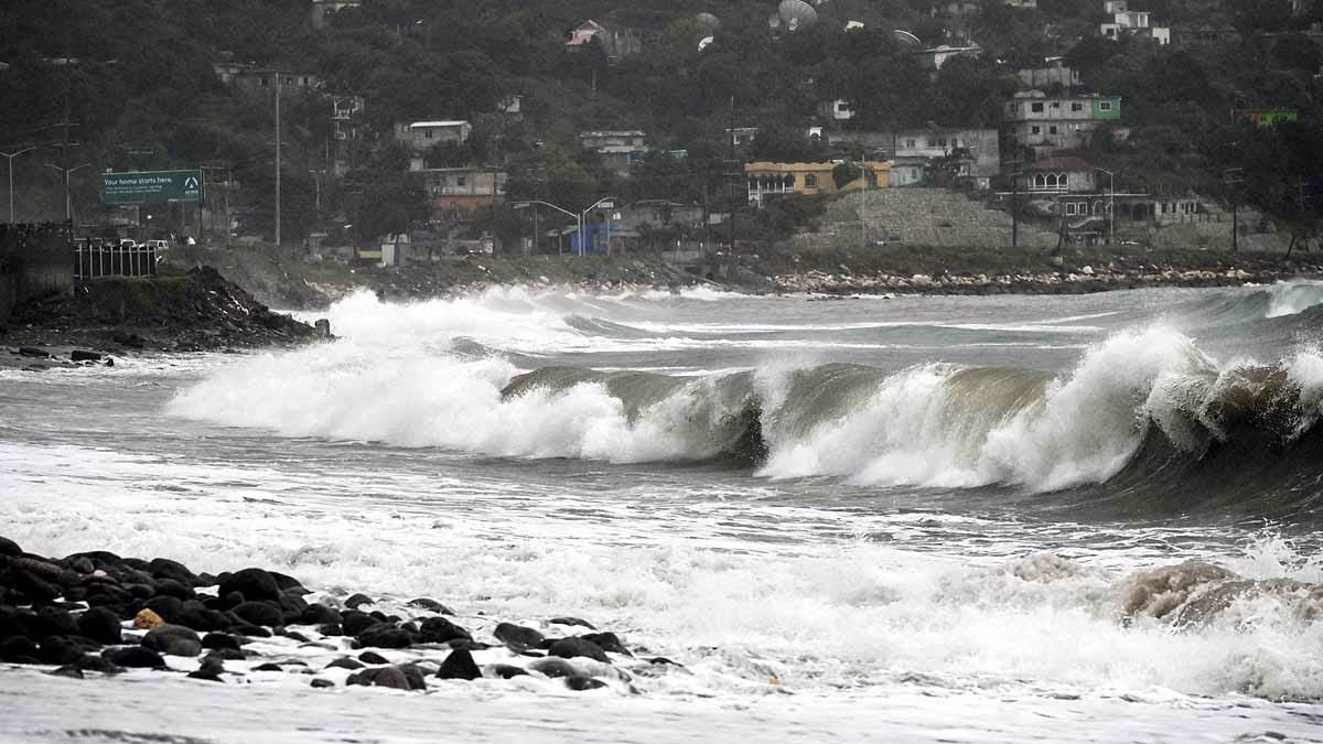
Path: Moving northwest from the Bay of Bengal, 10-15 feet sea surges, 10-20 inches rain are expected.
Difference from hurricanes: Montha advances moderately fast (15-20 km/h), while Melissa progresses slowly yet more forcefully (5-10 mph, winds twice as strong). Cyclones bring more rain, hurricanes more wind.
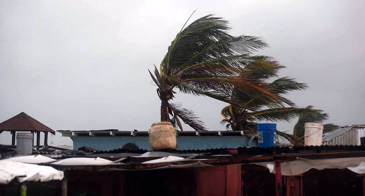
Melissa, the most potent storm of 2025, is a Category 5 hurricane, boasting 282 km/h winds and a pressure of 906 mb, signifying extreme strength.
Trajectory: From Africa, crossing the Caribbean - already causing rain in Haiti/Dominican Republic, hitting Jamaica on October 29, then Cuba/Bahamas. Forecasted 40 inches of rain and 20-foot waves, landslides imminent.
Weather conditions: Intense warmth (30°C+), slow-moving, worsening potential damage.
Different from cyclones: Melissa heightened rapidly to Cat 5 within 2 days, whereas Montha gradually intensified. Hurricane's 'eye wall' presents notable hazard.
Source: aajtak
Montha is nearing landfall, with Andhra Pradesh and Odisha bracing for significant impacts - flash floods from heavy rain, infrastructural damage from winds, and coastal submersions due to sea waves. Thousands could be impacted, damaging crops/fisheries. NDRF is deployed; mass evacuations underway.
Damage estimate: $1-2 billion, though zero fatalities is the target.
Diverging from hurricanes: Montha hits impoverished coastal areas where preparations are ongoing. Hurricanes often affect richer nations, but Melissa is targeting vulnerable islands.
Melissa is set to be Jamaica's most catastrophic storm, already causing 4 fatalities in Haiti. Predicted damage: $50-100 billion, with extensive housing loss and life-threatening floods and landslides. Up to 40 inches of rain, 160-180 mph winds lead to power and water outages. Worse conditions expected in Cuba/Haiti, meriting its potential name retirement.
Advice: Relocate to higher ground, stay tuned to radios, stockpile food and medicine.
Difference from cyclones: Melissa idles longer due to slow movement (similar to Hurricane Ian in 2022), while Montha will pass quickly.
Protection from both: Heed warnings, plant trees, curb climate change.