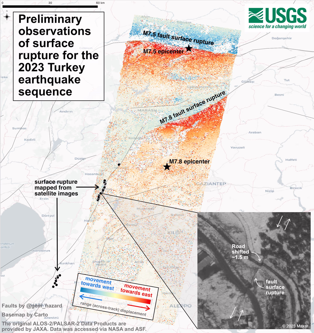
The U.S. Geological Survey (USGS), known for studying earthquakes, has been analyzing the recent seismic activities of 7.8 and 7.5 magnitudes in Turkey and Syria. Their satellite imagery has confirmed the ground in Turkey has indeed shifted.
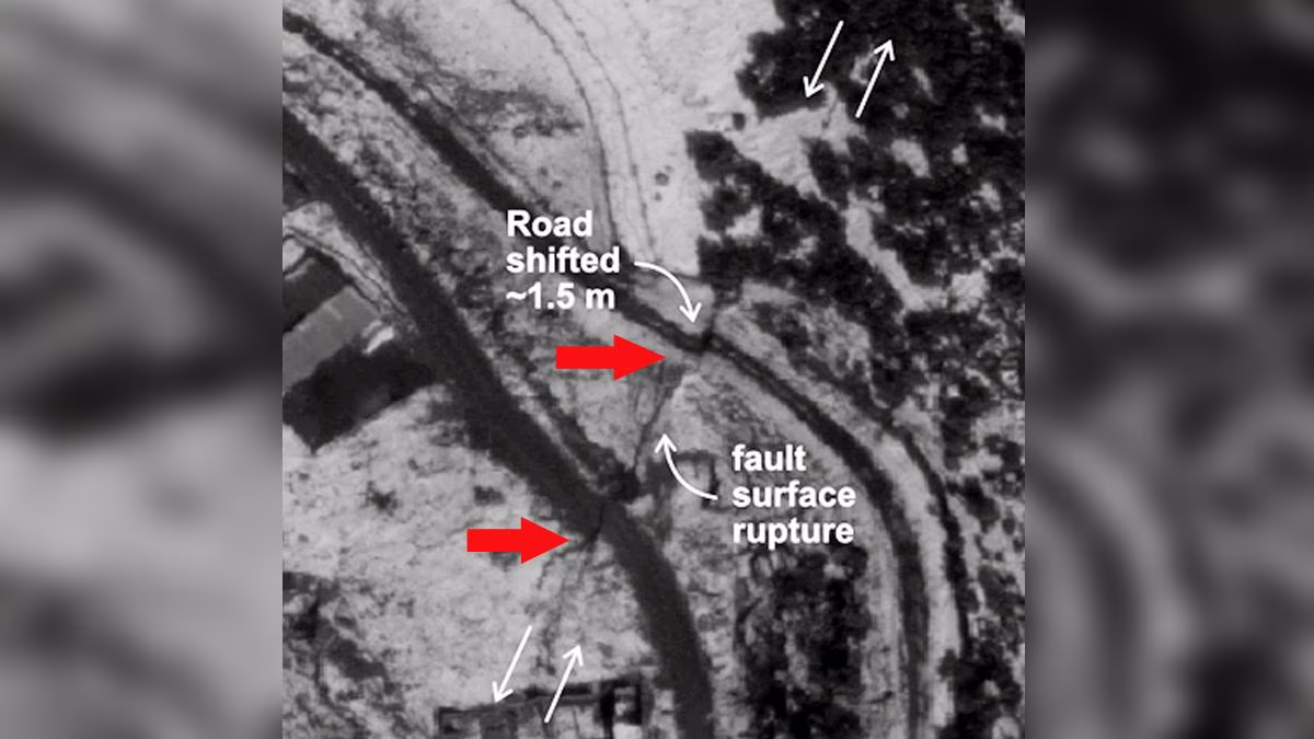
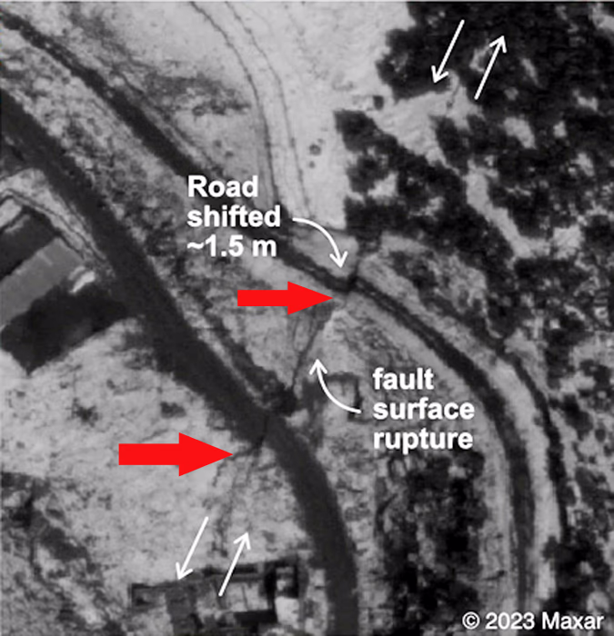
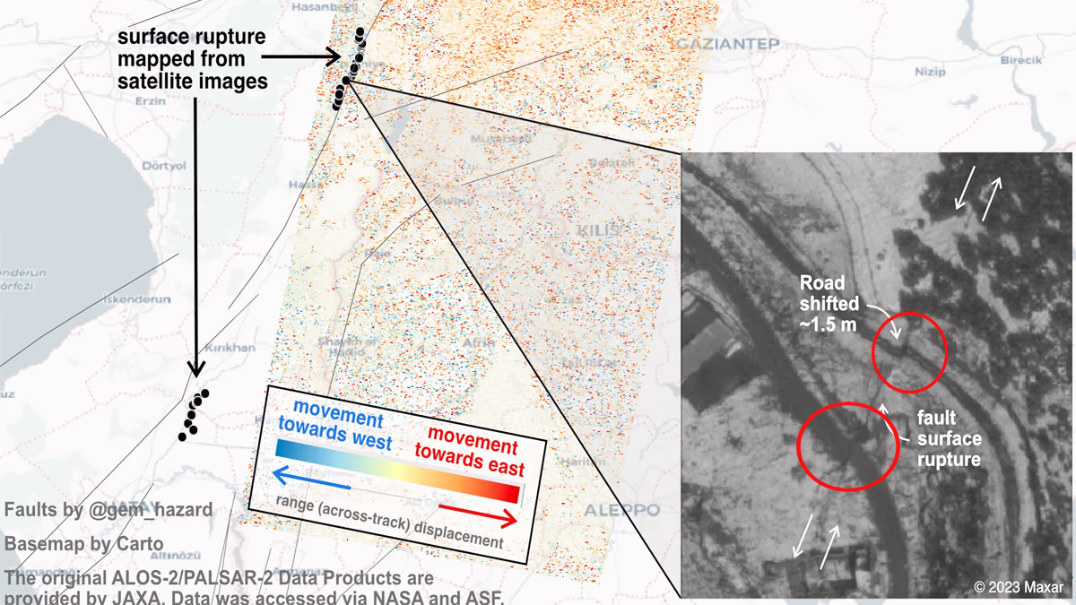
The images from USGS highlight where cracks appeared on the surface due to both earthquakes. One particular image captured by Maxar's satellite shows two roads separated into two parts in a field, indicating that the fault line ran between them. The earthquake caused the fault line to shift, resulting in surface cracks. This is USGS’s preliminary report, but the satellite images provide undeniable proof.
Source: aajtak
According to USGS, the fault line's crack extends approximately 300 kilometers. Previously, Prof. Dr. Hasan Sozbilir of Izmir Dokuz Eylul University, Director of the Earthquake Research and Application Center, noted that three fault lines have broken from within. This phenomenon spans a distance of roughly 500 kilometers. Both a Turkish expert and the American organization agree: the ground has indeed shifted.
Dr. Hasan mentioned that the cracks from the recent earthquakes are larger than those from the Gölcük earthquake on August 17, 1999, and the Duzce earthquake on November 12, 1999. The 7.8 and 7.5 magnitude earthquakes shook Turkey's eastern, southeastern, Mediterranean, Central Anatolian, and Black Sea regions. Such a seismic event hasn’t been recorded in Turkey's history in the past 100 years.
Source: aajtak
More evidence comes from Italy's National Institute of Geophysics and Volcanology's head, Prof. Carlo Doglioni, claiming that due to these earthquakes, Turkish soil moved 10 feet. He stated this after analyzing the earthquakes between Kahramanmaraş and Malatya. Prof. Carlo works for the same institution that reported Japan's eight-inch shift after the 2011 tsunami.
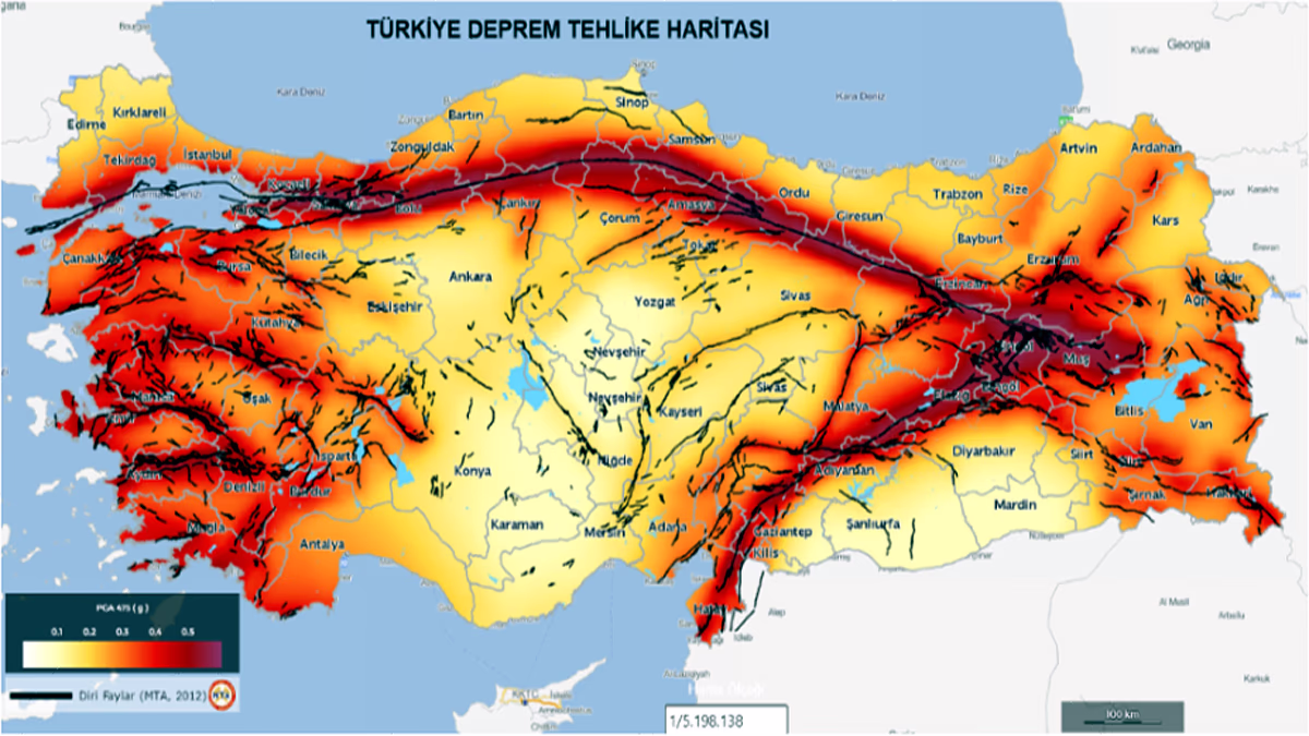
Areas Most Affected by the Crack
Most of Turkey lies on the Anatolian microplate, but the southeastern and eastern parts are on the Arabian Plate, covering areas like Gaziantep, Adıyaman, Diyarbakır, Şanlıurfa, Mardin, Batman, Siirt, Bingöl, Muş, Bitlis, Şırnak, Van, Erzurum, Ağrı, Iğdır, and Hakkari. The USGS image shows a road west of Gaziantep affected by the shift. Dr. Carlo noted the displacement spans approximately 150 kilometers.
Source: aajtak
Other Scientists Agree
Prof. Carlo believes Turkey's three major fault lines caused these events, leaning significantly over each other, with displacement occurring in the lower sections, increasing the distance between the fault line sections. Consequently, the Turkish Plate moved further from the Arabian Plate. Meanwhile, Durham University’s Prof. Bob Holdsworth attributed earthquakes to tectonic plates converging, pushing, or diverging.
Prof. Bob emphasizes the natural law accepted by scientists globally: earthquakes measuring 6.5 to 6.9 in magnitude can shift tectonic plates up to a meter, approximately three feet. Larger earthquakes might displace a country 10 to 15 meters, that is, 30 to 45 feet. Prof. Bob notes intense earthquake activity can horizontally displace tectonic plates near Turkey (strike and slip), moving them 3 to 6 meters, approximately 10 to 18 feet.
Source: aajtak
Japan's Ground Shift in 2011
The catastrophic tsunami following the March 2011 earthquake in Japan caused an eight-foot ground shift. The Japanese earthquake also affected Earth’s axis. USGS Geophysicist Kenneth Hudnut told CNN their GPS station shifted eight feet; data from the Geospatial Information Authority confirmed this observation.
Italy’s National Institute of Geophysics and Volcanology made similar claims, stating the 8.9 magnitude earthquake in Japan displaced coastal areas and shifted Earth’s axis by approximately four inches.
USGS Geophysicist Shengzao Chen explained the severe seismic event in Japan resulted from a 400-kilometer-long and 160-kilometer-wide crack in Earth’s crust, caused by tectonic plate subduction. Two plates shifted around 18 meters.
Turkey's Underlying Activity on February 6
Clearly depicted on this map, the Anatolian Microplates are moving towards the Aegean Microplates. Meanwhile, the Arabian Tectonic Plate is pressuring Turkey's Plate, while the Eurasian Plate shifts in another direction. The force released from these colliding plates is causing significant earth tremors.
Turkey's tectonic plate is split into two parts: the surface-on structure and a deeper section. The lower plate, previously behind, is shifting forward due to pressure, potentially causing the upper ground to fracture, creating a large crack or splitting the country if the plates continue to weaken. The Anatolian Microplates lack strength compared to larger plates.