Taiwan has been rocked by a catastrophic earthquake, leading to widespread destruction and tsunami warnings. The tremors were felt across Japan and nearby nations, reminding everyone that Taiwan is situated on the volatile Pacific Ring of Fire, an area prone to earthquakes and volcanic activity.
But how did such a massive earthquake occur?
Taiwan rests atop an intricate tectonic plate setting. Beyond minor plates and faults, focusing on the major tectonic plate boundaries, picture this scenario...
Also Read:
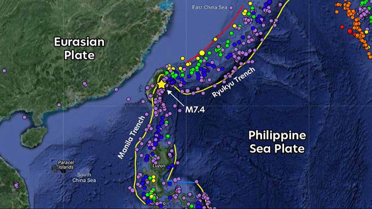
Near the Ryukyu Trench, the Philippine Sea Plate subducts under the Eurasian Plate, defining a deep oceanic trench. Conversely, at the Manila Trench, the Eurasian Plate subducts under the Philippine Sea Plate. This places the land underneath Taiwan in a precarious position, like a three-layered geological sandwich.
Source: aajtak
Any movement in one of these plates impacts both trench systems. Minor earthquakes are a constant here, but a quake of this magnitude suggests an immense pressure release caused by the shifting, grinding, overlaying, subsiding, or fracturing of tectonic plates.
Understanding Taiwan's Subterranean Landscape
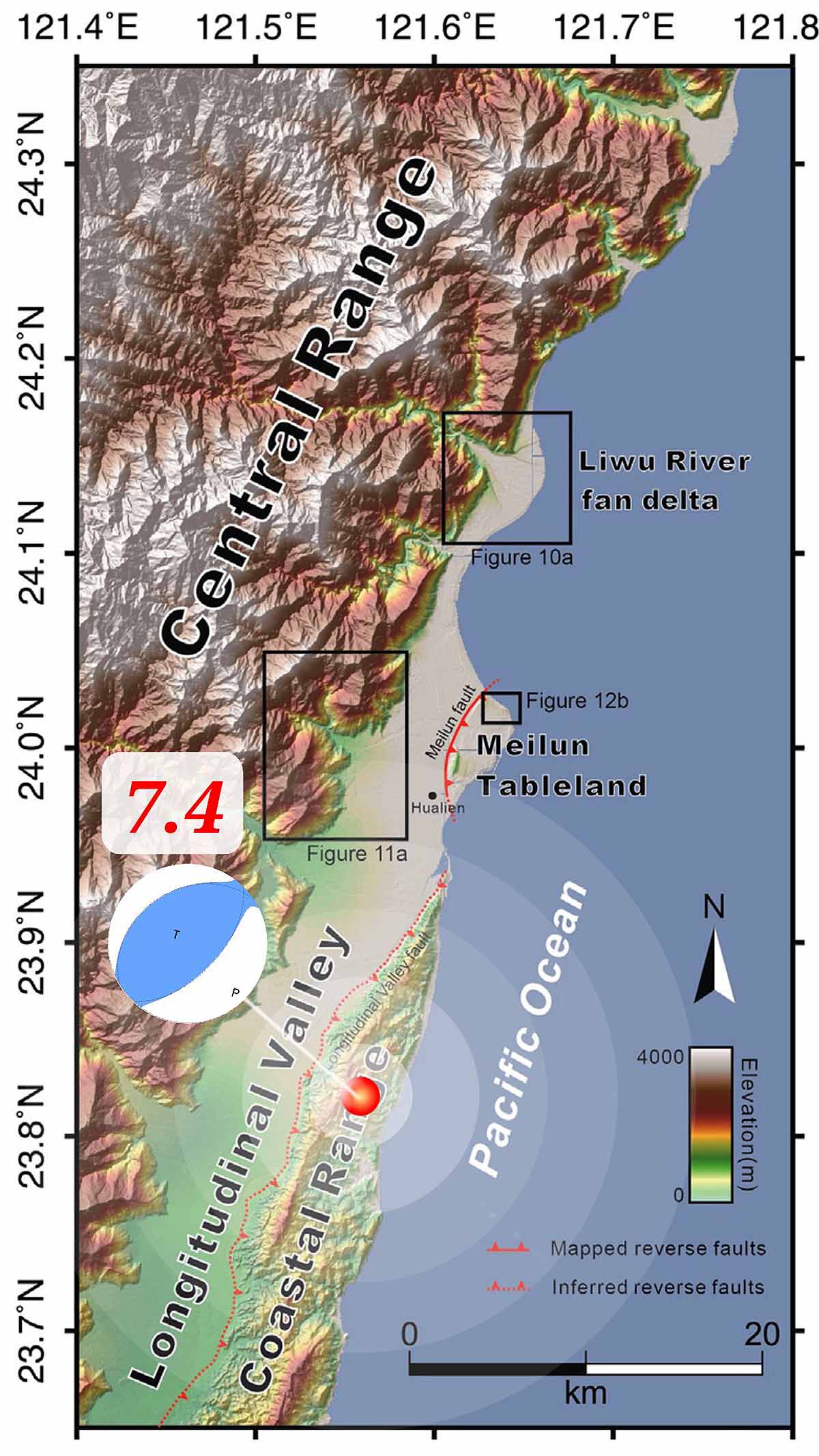
Taiwan is perched on an underwater mountain tip. On one side, it connects to an elevated underwater region stretching towards China, covering the northwest, west, and southwest. On the opposite side, to the northeast, east, and southeast, lies a deep valley known as the Longitudinal Valley, created by the collision of the Philippine Sea and Eurasian Plates, resulting in vast underwater fissures.
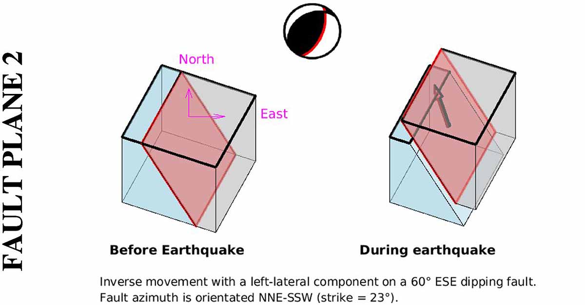
Featured within the northern section is the curved Ryukyu Subduction System. Another significant trench is the Manila Trench. Scientists have discovered two reverse faults beneath Taiwan, unusual in orientation compared to common faults.
Source: aajtak
One fault extends from east to west underneath the Liwu River Fan Delta, slanting southward. The other runs from north to south, leaning eastward near Taiwan's Central Mountain Range. These faults converge around 10 kilometers deep in the ocean, contributing to the region's twisted geographic structure.
The Meilun Fault, responsible for the 7.3 magnitude earthquake in October 1951, had been dormant for two decades. However, it's possible that this time the fault has reactivated or spawned a new one, disturbing the Eurasian and Philippine Sea Plates.