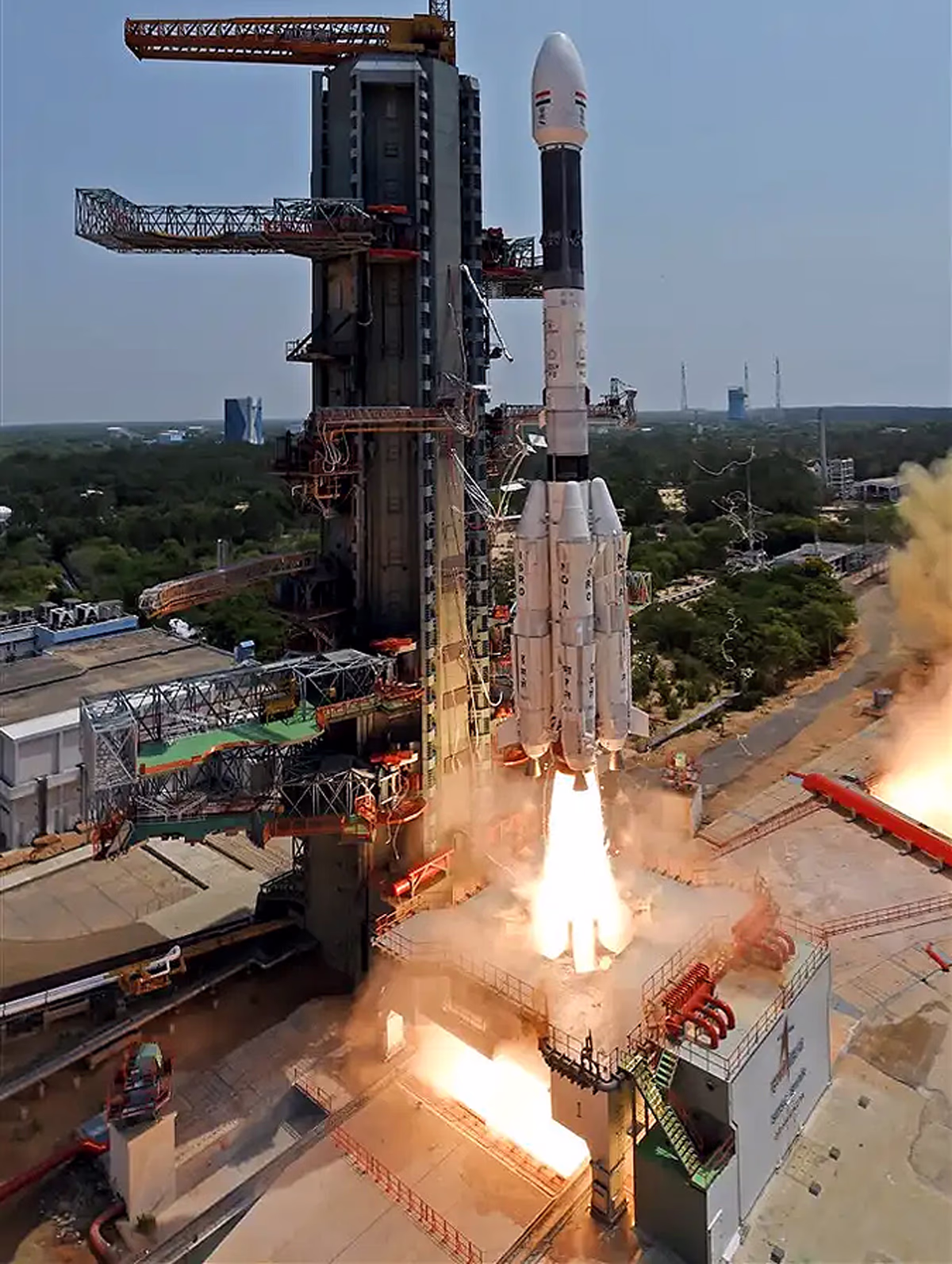
July 30, 2025, marked a historic occasion for India and the world with the successful launch of the NISAR (NASA-ISRO Synthetic Aperture Radar) satellite from the Satish Dhawan Space Centre at Sriharikota at 5:40 PM.
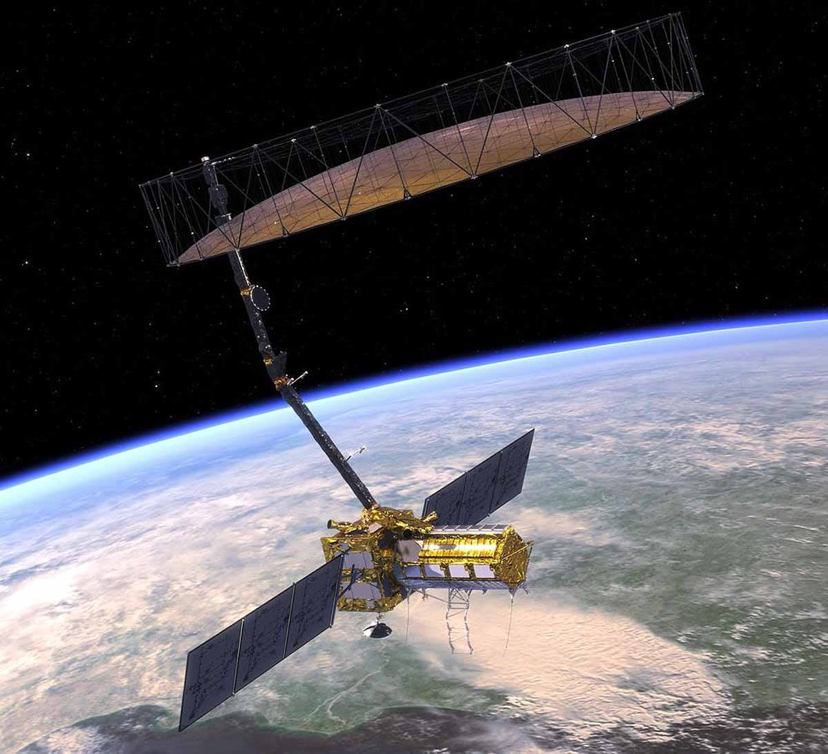
This collaboration between ISRO and NASA has sent a satellite into Earth's orbit that will predict natural disasters like earthquakes, tsunamis, volcanoes, and landslides. This satellite is considered Earth's MRI scanner, capable of capturing incredibly detailed images to detect even minute changes in the Earth's surface.
Also read:
The Kamchatka Earthquake and the Need for NISAR
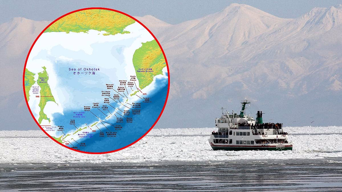
On July 30, 2025, an 8.8 magnitude earthquake struck near the Sea of Okhotsk off the coast of Russia’s Kamchatka Peninsula, triggering tsunami alerts across 12 countries—Russia, Japan, Hawaii, California, Alaska, Solomon Islands, Chile, Ecuador, Peru, the Philippines, Guam, and New Zealand.
The earthquake's force was equivalent to 9,000-14,000 Hiroshima-sized nuclear bombs. The Kuril Islands experienced waves as high as 5 meters. People in Fukushima, Japan, early remembered the 2011 tsunami.
Also read:
Receiving warnings ahead of such disasters is crucial. This is where NISAR excels. It can detect minor ground movements preceding earthquakes and predict potential tsunami scenarios, enhancing the precision and speed of disaster management efforts to minimize losses.
Source: aajtak
How Does NISAR Provide Disaster Warnings?
NISAR specializes in pre-disaster warnings...
Earthquakes: It detects slight movements along fault lines (cracks in the Earth), predicting likely earthquake events.
Tsunamis: After an earthquake, it monitors marine disturbances and coastal flooding to issue tsunami alerts.
Volcanoes: By observing the activity or swelling beneath volcanoes, it can predict eruptions.
Landslides and Floods: It measures soil movement in mountainous areas or river water levels to provide alerts.
Also read:
Why Is NISAR Crucial for India?
In India, disasters like earthquakes in the Himalayas, floods in Assam and Kerala, and landslides in Uttarakhand are common. NISAR's early warnings are vital for saving lives and property. Additionally...
Agriculture: Information on crops and soil moisture aids farmers.
Water Management: Monitoring groundwater and river levels helps counter water shortages.
Coastal Safety: Tracking coastal erosion and sea ice preserves the marine environment.
Source: aajtak
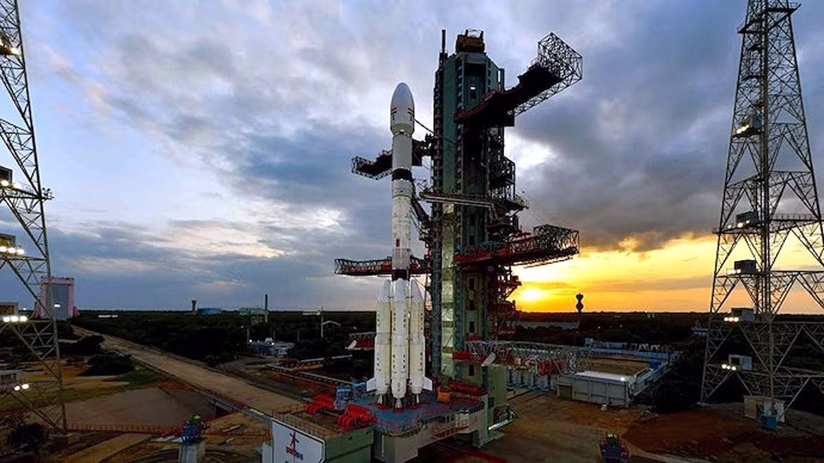
The Story Behind the Launch
NISAR was launched aboard ISRO's GSLV-F16 rocket. This marked the first time GSLV delivered a satellite into a sun-synchronous orbit. Weighing in at 2,392-2,800 kilograms, it is as large as an SUV. The launch was watched live by millions on ISRO's YouTube channel. Initially slated for March 2024, the mission was postponed due to antenna heating issues, which NASA subsequently resolved. The mission is now a complete success.