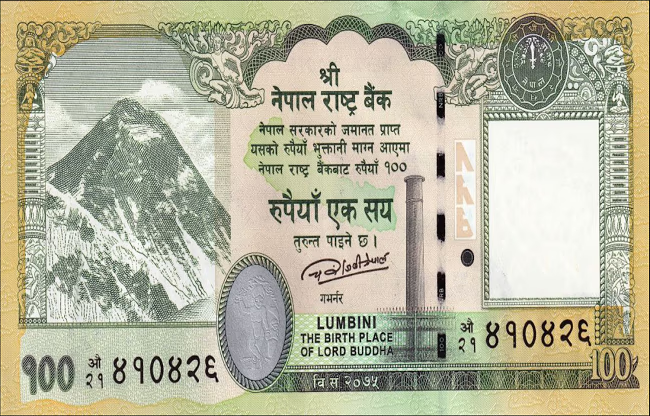
The neighboring country Nepal has once again taken an action causing a stir in India. The government there redesigned the 100-rupee note to include regions that are part of Uttarakhand, India. These notes, printed by a Chinese company, hint at ulterior motives. Both India and Nepal have claimed this disputed area, encompassing around 372 square kilometers, as theirs. These areas are within Pithoragarh in Uttarakhand.
The choice of China for printing the new currency raises suspicion. Kathmandu's Central Bank awarded the contract to China Banknote Printing and Minting Corporation for redesigning, printing, and supplying the currency. This will result in 300 million copies circulating throughout Nepal. The new currency contract includes a map of Nepal that controversially incorporates disputed regions.
This decision was made during the government of Pushpa Kamal Dahal in May this year. Although the Kathmandu Central Bank has the authority to redesign notes, it requires government approval. The continuation of the notes in the same design even after a change in the government raises concerns. Remember, during the COVID period, Nepal also issued a new political map including Lipulekh, Limpiyadhura, and Kalapani as part of its territory. At that time, India strongly opposed.

Source: aajtak
The boundary dispute between Nepal and India is more than a century old, dating back to the treaty of Sugauli signed between the two nations during British rule in India. It involves a valley in the region bordering India, Nepal, and China, originating from the Kali River, also known as Kalapani. Lipulekh and Limpiyadhura passes are located here.
According to the treaty, the boundaries were determined based on the Kali River, marking the west as India and the east as Nepal. However, the exact source of the river has been a cause of contention. Kathmandu and New Delhi have both laid claims to Kalapani, yet administratively, these disputed regions have remained part of India for decades.
The areas of Kalapani, Limpiyadhura, and Lipulekh are located within Pithoragarh, Uttarakhand. Local residents are Indian citizens, possess Indian identity cards, and pay taxes in India.
In recent years, Nepal has exacerbated this issue. In 2020, it released a new political map, including all three regions. It’s worth mentioning that Nepal’s reliance on China has increased in recent years. Nepal even signed a deal with China for its contested currency. It’s believed that under China’s pressure and influence, Nepal is taking such steps. But what does China gain from this?

Source: aajtak
India already has a border dispute with China, and both countries compete economically. China has long attempted to sway India’s surrounding nations, such as Pakistan, Bangladesh, and Sri Lanka, into its corner by offering loans, thereby stirring hostility towards India. The same assumption surrounds Nepal's recent actions.
During Communist leader KP Oli’s tenure as Nepal’s Prime Minister, Chinese influence in Kathmandu increased significantly, with substantial investments in infrastructure. However, the actual intent behind these investments was more complex. Recently, India’s Defense Minister Rajnath Singh responded to Nepal’s objections regarding India’s road project through Lipulekh, suggesting misleading influences at play.
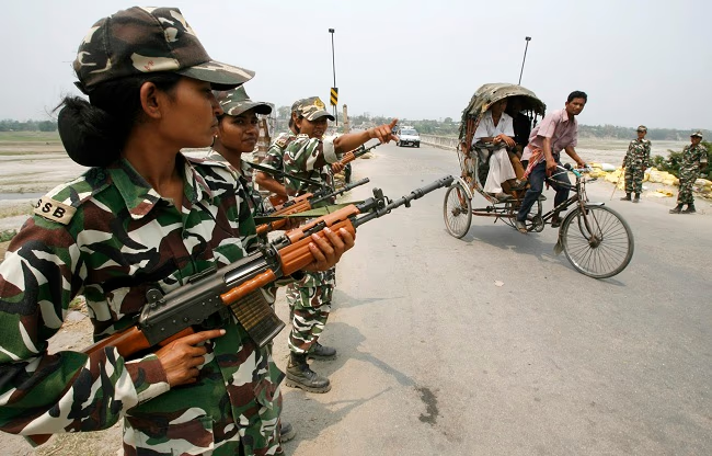
The disputed region spans approximately 335 square kilometers. Though not expansive, it is crucial since it lies at the tri-junction of India, Nepal, and China, remaining of strategic importance to India. It facilitates monitoring of Chinese military movements, which is why Indian-Tibetan border police are still stationed there.
Due to shared borders, Nepal and China had their boundary disputes, which were resolved shortly. During the 1950s and 1960s, the borders weren't clearly demarcated. There was uncertainty regarding boundaries between Tibet, China, and northern Nepal. Negotiations in the 1960s led to the signing of a boundary treaty, clearly outlining the borders, with markers established to avoid future disputes.


