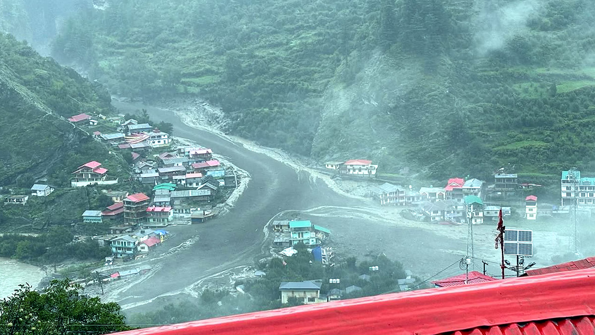
The shocking floods of mud and water that struck the village of Dharali in Uttarkashi district, Uttarakhand, on Tuesday, August 5, 2025, have left meteorologists baffled. Perched at an elevation of approximately 2,745 meters above sea level, the village was engulfed by debris and water in mere moments.
The disaster footage astonished everyone, showing swiftly flowing debris and water demolishing the village. Initial government reports pointed to a cloudburst, involving intense rainfall (over 100 mm per hour) within a short span.
Such incidents often trigger floods and landslides in mountainous regions. However, data from the India Meteorological Department (IMD) refuted these claims, as no cloudburst activity was recorded at any nearby weather station.
Read More:
This contradiction puzzled scientists. Some experts hypothesize that a cloudburst might have occurred at over 3,000 meters, where weather stations are non-existent. Rainfall from such elevations can trigger landslides and debris flows, as witnessed in Dharali.
Cloudbursts in the Himalayas typically occur between 1,000 to 2,500 meters, but are rare above 3,000 meters due to specific climatic conditions and orographic effects. This natural process involves mountains shaping wind and rainfall patterns.
Read More:
When moist, warm air ascends due to the steep Himalayan slopes, it cools and condenses, precipitating heavy rainfall. This leads to cloudbursts. However, above 3,000 meters, air becomes cooler and drier with reduced moisture, making heavy rain or cloudbursts unlikely. Hence, such phenomena are rare at higher altitudes.
Source: aajtak
Climate change is altering rainfall patterns in mountainous regions globally. Rising temperatures have shifted snow to rain, especially in higher elevations, causing a surge in intense rainfall events, leading to floods, landslides, and soil erosion.
Scientists assert that a 1-degree Celsius increase in global temperatures can raise average rainfall by about 15% in elevated regions. These changes are evident in the Himalayas, Alps, and North America's mountains.
Mountains are particularly sensitive to climate change, warming 25-50% faster than the global average. This impact manifests in various ways...
Decreased Snow: Reduced snow levels lead to erratic river flows.
Melting Glaciers: Rapid glacier melt forms glacial lakes, escalating the risk of Glacial Lake Outburst Floods (GLOFs).
Erratic Rainfall: Some regions witness increased intense rainfall, while others experience shifting wind and weather patterns.
Villages like Dharali, situated along the Bhagirathi River, are directly impacted by these shifts. A 2023 report by Nepal's International Centre for Integrated Mountain Development noted that over 200 of 2,000-plus glacial lakes in the Hindu Kush and Himalayan region pose breakout risks, endangering the villages below.
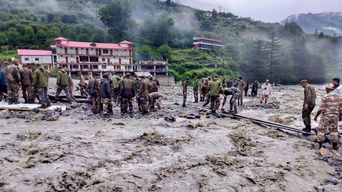
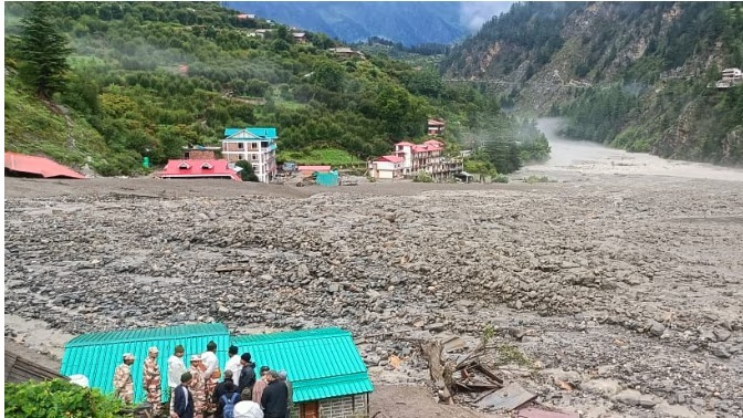
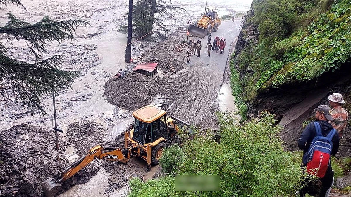
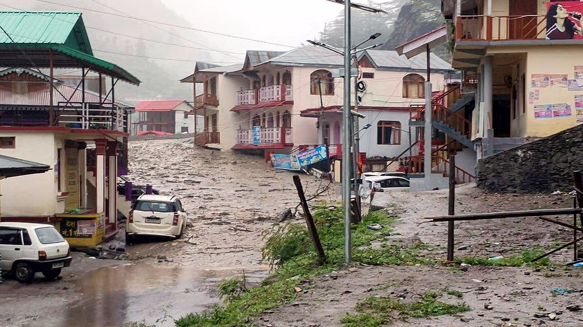
The August 5, 2025, disaster left much of Dharali buried under debris. Triggered by a suspected cloudburst in the upper reaches of the Kheer Ganga river, the avalanche of mud and water devastated the village, washing away homes, shops, hotels, and roads. Sadly, five people have died, and over 50 remain missing. Rescue efforts by the Indian Army, NDRF, SDRF, and ITBP continue, hampered by ongoing rains and blocked roads.
IMD data cites no cloudburst activity near Dharali that day. Yet, scientists conjecture that an event may have occurred above 3,000 meters, where weather stations are absent. The subsequent rush of debris and water reached Dharali. Additionally, the village's loose alluvial soil and steep slopes amplify disaster severity.
According to IMD, a cloudburst occurs when over 100 mm of rain falls in an hour within a 20-30 square km area. However, a 2023 study by Jammu IIT and the National Institute of Hydrology, Roorkee, offered a stricter definition...
Rainfall of 100-250 mm within one km² over a short period. Cloudbursts in Uttarakhand commonly occur between 1,000-2,000 meters. Dharali, at 1,160 meters, fits within this range.
Due to climate change, cloudburst occurrences are increasing, alongside their intensity. Warmer air holds more moisture, altering rainfall patterns. Heavy rain during the monsoon season in Uttarakhand is now commonplace. IMD cautioned of heavy rains statewide until August 10, 2025.
Source: aajtak
Nature isn’t the sole culprit for Dharali’s destruction. Haphazard construction, deforestation, and tourism pressures also share the blame. Dharali, a key stop en route to Gangotri Dham, has a proliferation of hotels, restaurants, and homestays. Often built without geological assessments, these structures contribute to the landslides and soil erosion.
To prevent disasters like Dharali’s, several crucial measures must be taken...
Enhanced Weather Monitoring: Install automatic weather stations (AWS) and satellite-based systems in higher areas to provide earlier cloudburst warnings.
Glacier and Lake Surveillance: Heighten surveillance of glacial lakes to reduce GLOF risks.
Sustainable Construction: Roads, dams, and buildings should adhere to seismic and environmental standards.
Forest Conservation: Protect forests to mitigate landslides and soil erosion.
Awareness and Preparedness: Provide community disaster management training. Strengthen SDRF and SDMA efforts in Uttarakhand.