Known as 'Devbhoomi', Uttarakhand is famed for its natural splendor, Himalayan peaks, and sacred rivers such as the Ganga, Yamuna, Bhagirathi, Alaknanda, and Rishiganga. Yet, in recent years, these once life-giving rivers have repeatedly become sources of devastation.
Floods, landslides, and glacial ruptures have become almost routine in Uttarakhand. Why is this happening? Is nature solely to blame, or are human errors contributing factors? Let's delve into this topic with insights from scientific research.
Read More:
Recurring Disasters in Uttarakhand: A Closer Look
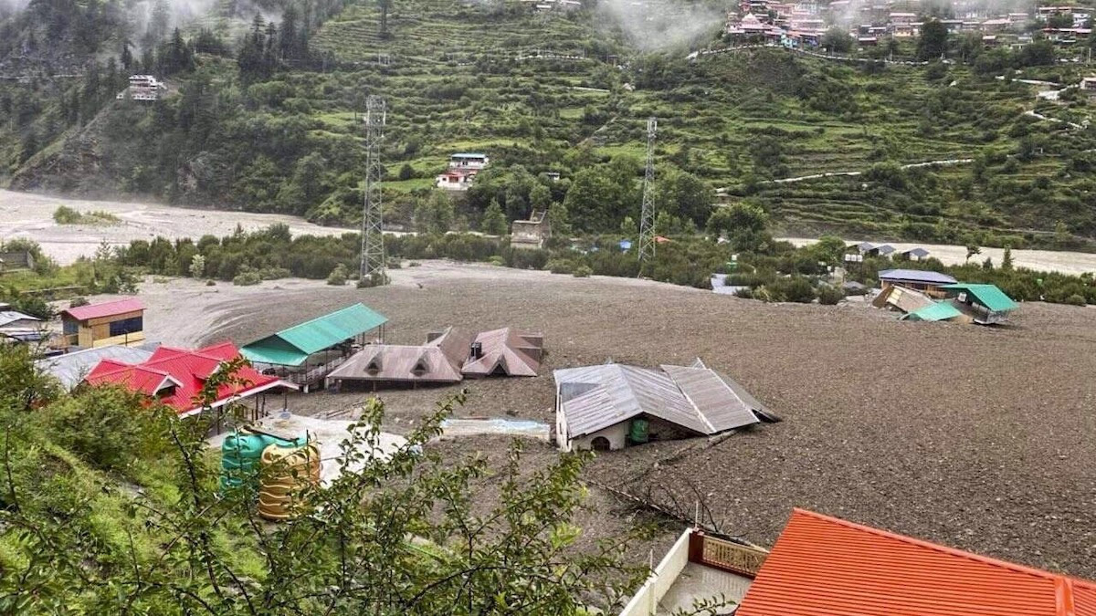
While natural disasters in Uttarakhand are not new, their frequency and intensity have increased in recent decades. For example...
Source: aajtak
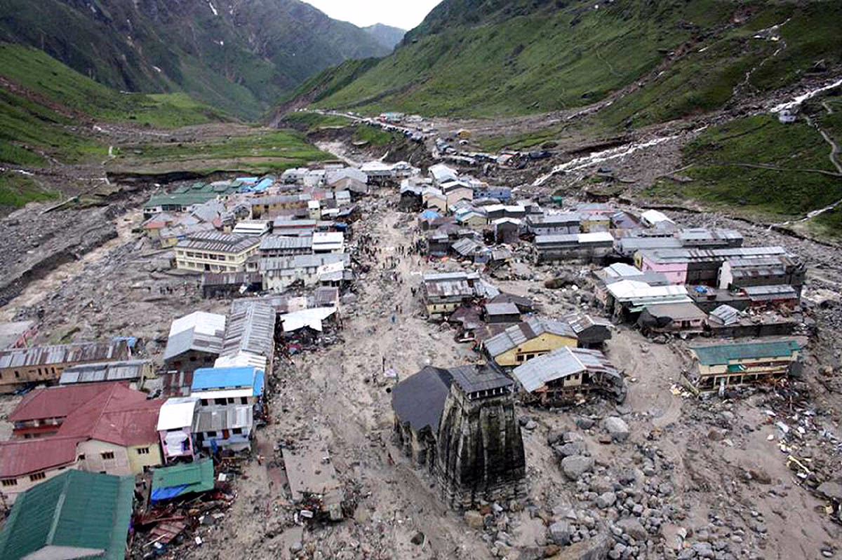
2013 Kedarnath Tragedy: Torrential rain and flooding in the Mandakini River claimed thousands of lives, causing immense destruction.
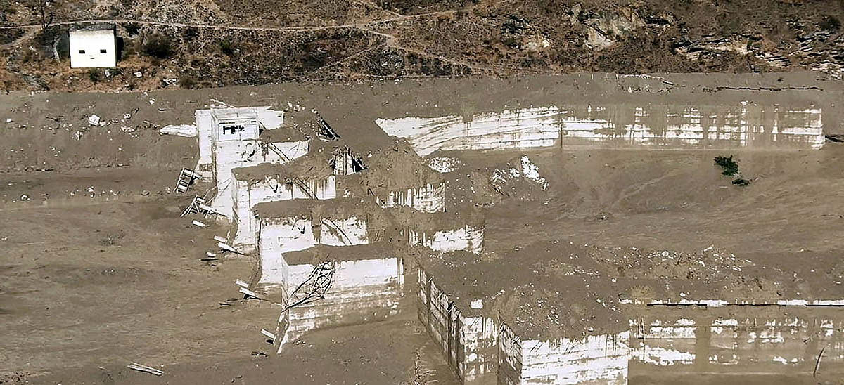
2021 Chamoli Disaster: Glacial break induced flooding in the Rishiganga and Dhauliganga rivers destroyed the Tapovan dam, resulting in numerous fatalities.
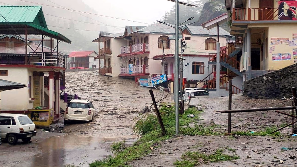
2023 Landslides and Floods: Monsoon season saw multiple landslides and river swells, sweeping away roads, bridges, and homes.
Causes of Destruction: The Nature-Human Nexus
Scientists suggest a combination of natural and anthropogenic factors behind Uttarakhand's disasters. Let's explore this in detail...
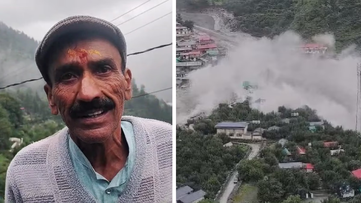
Read More: Viewing the Harrowing Scene, Dharali's Beautiful Vista Vanished in 34 Seconds
1. Geological Instability and Himalayan Formation
The Himalayas, a young mountain range, remain geologically active. Research indicates their height increases by 4-5 mm annually due to the collision between the Indian and Eurasian tectonic plates. This collision causes seismic activity, weakening rocks.
Scientific Fact:
According to a study by the Wadia Institute of Himalayan Geology, minor earthquakes (3.0-4.0 magnitude) frequently occur in Uttarakhand, potentially indicating future larger quakes (magnitude 7.0).
Impact:
Seismic disturbances weaken mountain rocks, elevating landslide and flood risks, particularly in areas bordering the Alaknanda and Bhagirathi rivers.
Source: aajtak
2. Melting Glaciers and Climate Change
Uttarakhand’s rivers such as Bhagirathi, Alaknanda, and Rishiganga originate from glaciers. Climate change accelerates glacier melting, precipitating sudden floods.
Scientific Fact:
According to the National Centre for Polar and Ocean Research, Himalayan glaciers are shrinking annually by 0.5-1%. The Gangotri glacier, source of Bhagirathi River, has receded approximately 1.5 km over the last 50 years.
2021 Chamoli Disaster Example:
A glacial break triggered flash floods in the Rishiganga and Dhauliganga rivers, devastating the Tapovan dam. Researchers linked this to a combination of glacial melt and rock fragmentation.
3. Human Activities: Nature's Burden
Expanding tourism, unplanned construction, and hydroelectric projects compound the destruction...
Read More:
Unplanned Construction and Mining: Roads
, tunnels, and dams in mountains involve extensive drilling and blasting, weakening rocks and increasing landslide risks.
Example:
In 2021, a 550-meter stretch of mountainside in Chamoli district collapsed, causing severe devastation in Tapovan. Environmentalists attribute this to dam construction activities.
Tourism Pressure:
Uttarakhand attracts over 40 million tourists yearly, especially to pilgrimages like Badrinath, Kedarnath, Gangotri, and Yamunotri, escalating deforestation, waste, and natural resource strain.
Hydroelectric Projects:
Numerous dams on Alaknanda and Bhagirathi rivers disrupt their natural flow, heightening flood risks. A study reveals over 70 hydroelectric projects in Uttarakhand, many in earthquake-prone areas.
Source: aajtak
4. Changing Weather Patterns
Instances of heavy rainfall and cloudbursts in Uttarakhand are rising. According to the India Meteorological Department, monsoon rainfall intensity in Uttarakhand rose 20-30% over the past 20 years...
Impact:
Heavy rains cause rivers like Mandakini, Alaknanda, and Bhagirathi to surge, resulting in floods and landslides. The 2013 Kedarnath tragedy, with the Mandakini River causing havoc, stands as the starkest example.
Scientific Fact:
A research paper highlights increased cloudburst incidents in the Himalayan region due to climate change, with warmer air retaining more moisture, leading to sudden heavy rains.
What Are the Solutions?
To prevent Uttarakhand's rivers and mountains from being sources of destruction, several measures can be taken...
Sustainable Development: Construct roads and dams considering seismic and environmental impacts. Scientists recommend small, eco-friendly dams.
Glacier Monitoring: Enhance the use of satellites and sensors to monitor glaciers and provide early flood warnings.
Tourism Control: Limit tourist numbers at pilgrimage sites and enforce stringent waste management rules.
Forest and Environmental Conservation: Prevent deforestation and plant trees to reduce landslides. Over 60% of Uttarakhand is forested, yet illegal logging weakens it.
Local Awareness: Equip local communities with disaster management training for prompt response in emergencies.