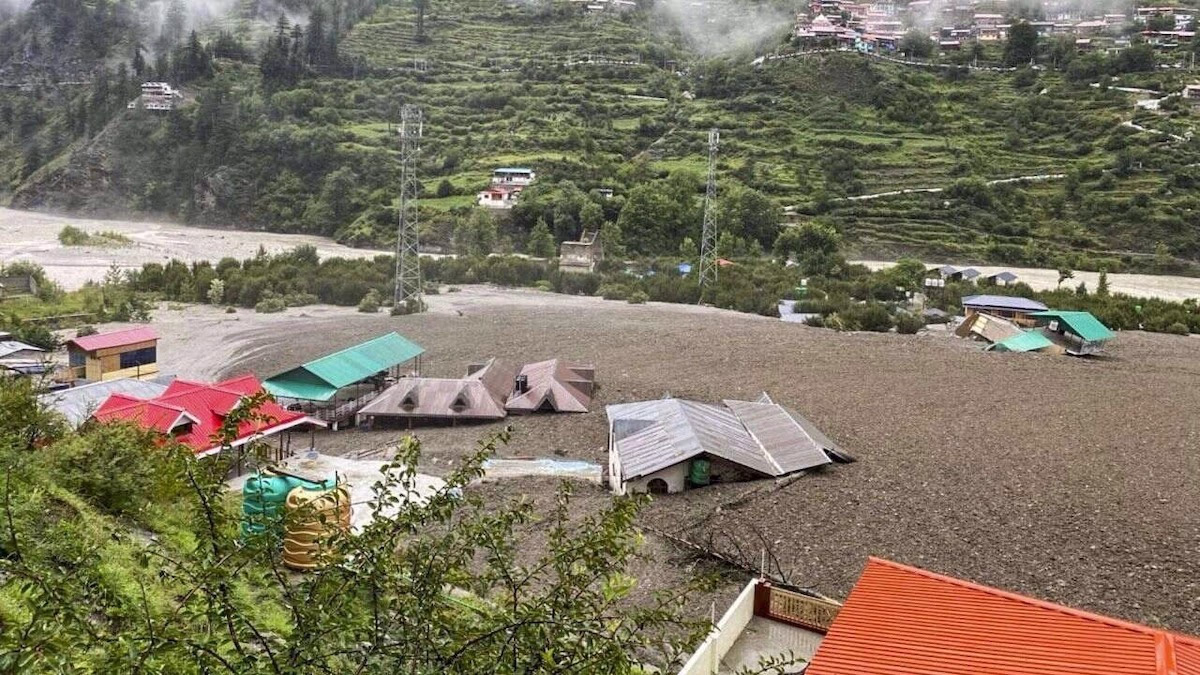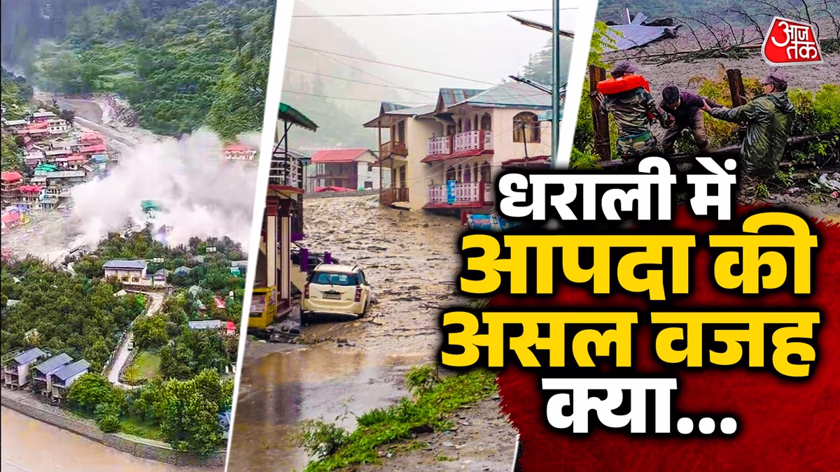
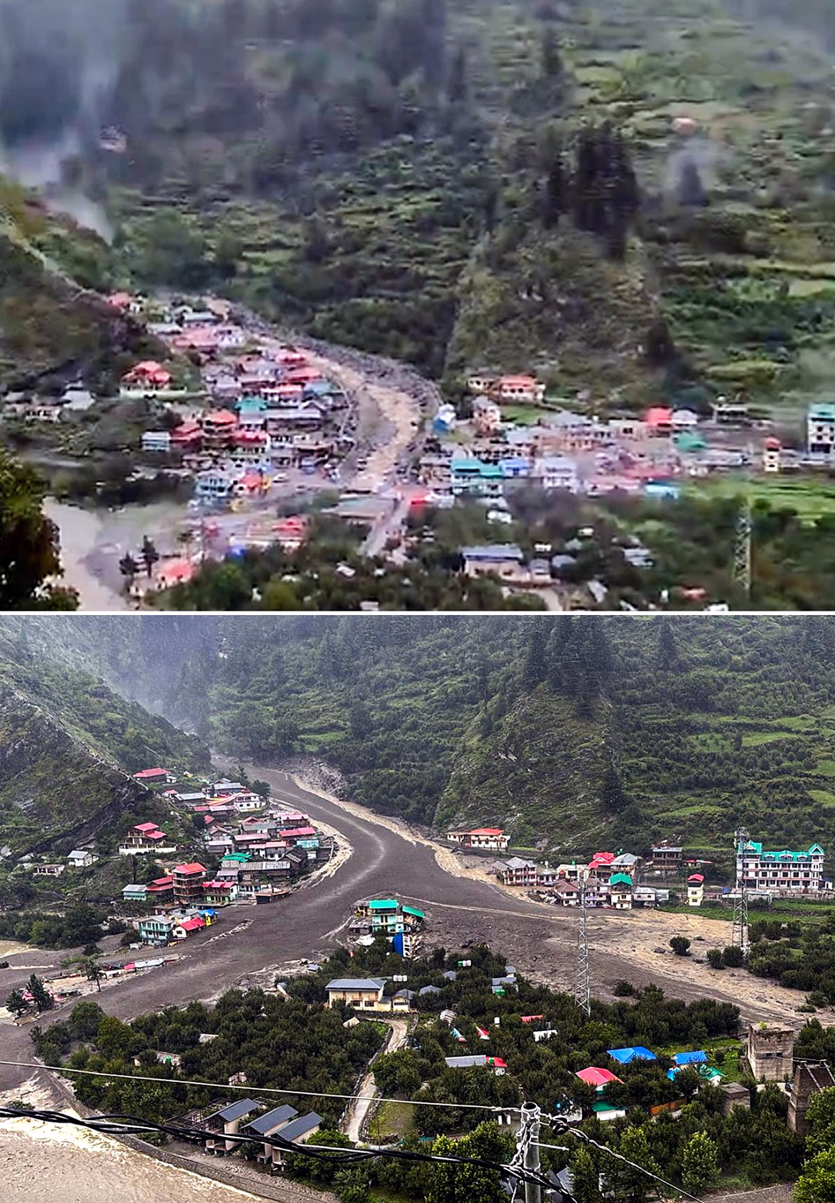
The tranquil Dharali village near Harsil in Uttarkashi experienced unforeseen calamity on Tuesday. Within just 30 to 35 seconds, a serene mountainous village was decimated by debris-laden torrents. Triggered by 12,600 feet tall mountains, merciless waters swept downhill, razing the hamlet in no time. Initially, a cloudburst was suspected to be the cause.
Aajtak.in
engaged experts to investigate potential links leading to this catastrophe.
First Possibility: Was it a Cloudburst?
Surprisingly, the meteorological website did not record rainfall levels to suggest a cloudburst. According to meteorologists, rainfall on August 4th and 5th was between 8 mm to 10 mm. Retired glaciologist Dr. D.P. Doval remarked that the criteria for cloudburst – over 100 mm of rain within an hour – were unmet. The flash flood occurred at noon, indicating a cloudburst might not be the cause.
District Disaster Management Officer Shardul Gusain noted recorded cloudburst incidents in Dharali, Harsil, and Sukhitop. He observed that preliminary evidence pointed to a cloudburst. However, clearer understanding awaited the arrival of fresh data.
Second possibility: Temporary Lake or Dam Collapse Due to Rain
Glaciologist Dr. D.P. Doval speculated -
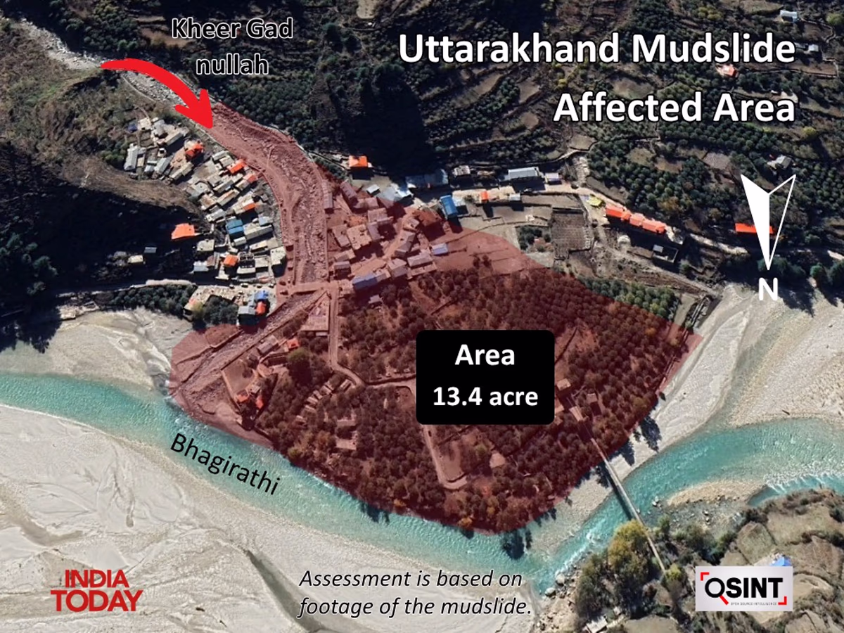
"Dharali is located on a floodplain. I had previously warned of potential risks. Behind Dharali lies an immensely dense forest stretching over 1.5 to 2 km. The Kheer Gaad stream, provoking the flash flood, originates from these woods. Above it is Mount Shrikhand, snow-covered. Typically, a flash flood initiated by a cloudburst would gradually accelerate before slowing. However, the current is swift, implying the cause might differ."
Source: aajtak
Dr. Doval suggested the water and debris came from previous iced-over areas. Yet, recent satellite images showed no visible lake formations. An unseen lake amid the forest might have broken, possibly dislodged by rock or weakened by the rainfall, akin to the Rishiganga disaster.
Two Pre-existing Lakes
Analyzing the area using Google Earth revealed glacier-laden peaks with noticeable fractures in the catchment area behind Dharali. Possibly originating from ice avalanches, debris accelerated downward. The Dharali devastation video showcased rapid descents, facilitated by steep slopes.
Source: aajtak
Images from 2022 identified two minor lakes by the glacier’s peak, nearing a confluence. An avalanche generated by their merger could have triggered this disaster, reminiscent of Chamoli's Rishiganga incident in 2021.
Third Possibility: Climate Change Elevating Cloudbursts
Nowadays, climate change is potentially pushing cloudbursts to occur 3,000-4,000 meters high, unlike the usual 1,000-2,000 meters elevations. Ordinarily, rainfall transpires at lower elevations while snow occurs higher. Evolving climatic patterns and rising temperatures challenge these norms. Persistent rainfall combined with glacier melts can topple lakes, inundating lower zones forcefully.
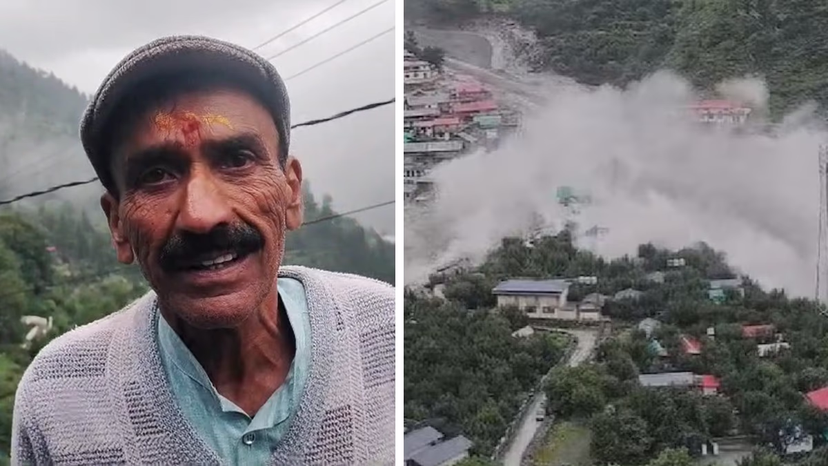
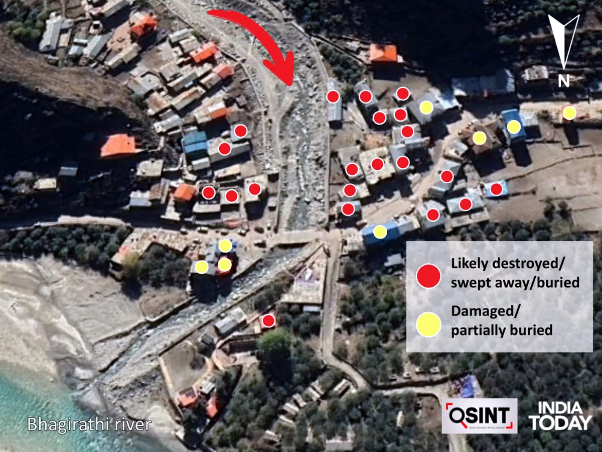
What does the video of Dharali’s devastation indicate?
Analyzing video footage of Dharali’s destruction reveals sudden, rapid torrents likely due to an unforeseen rupture. This deluge carried not only water but slurry-like debris, bringing upper deposits downstream.
Source: aajtak
The destruction in Dharali is particularly concerning due to dense settlements. The area adjacent to Gangotri and Harsil hosts popular tourist spots. Due to its touristic allure, accommodations like hotels and homestays, primarily near the river, witness substantial habitation, exacerbating the flood's impact.
What constitutes a cloudburst?
A cloudburst is a natural phenomenon where more than 10 cm (100 mm) of rain falls in a small area within an hour. In mountainous regions like the Himalayas, hot, moisture-laden clouds collide with mountains, initiating sudden heavy rainfall. Consequently, streams swell, causing floods and landslides, often termed Himalayan tsunamis. Anticipating such events in advance remains challenging due to its rapidity.