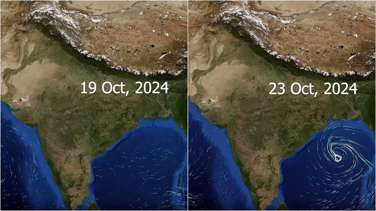
Cyclone Dana is swiftly approaching Odisha and West Bengal. The cyclone might slam between Puri in Odisha and Sagardwip in West Bengal at a speed of 120 km/hr. Coastal state governments are ensuring people's safety by relocating them. Fishermen have securely anchored their boats ashore. But how was it detected that the storm was imminent?
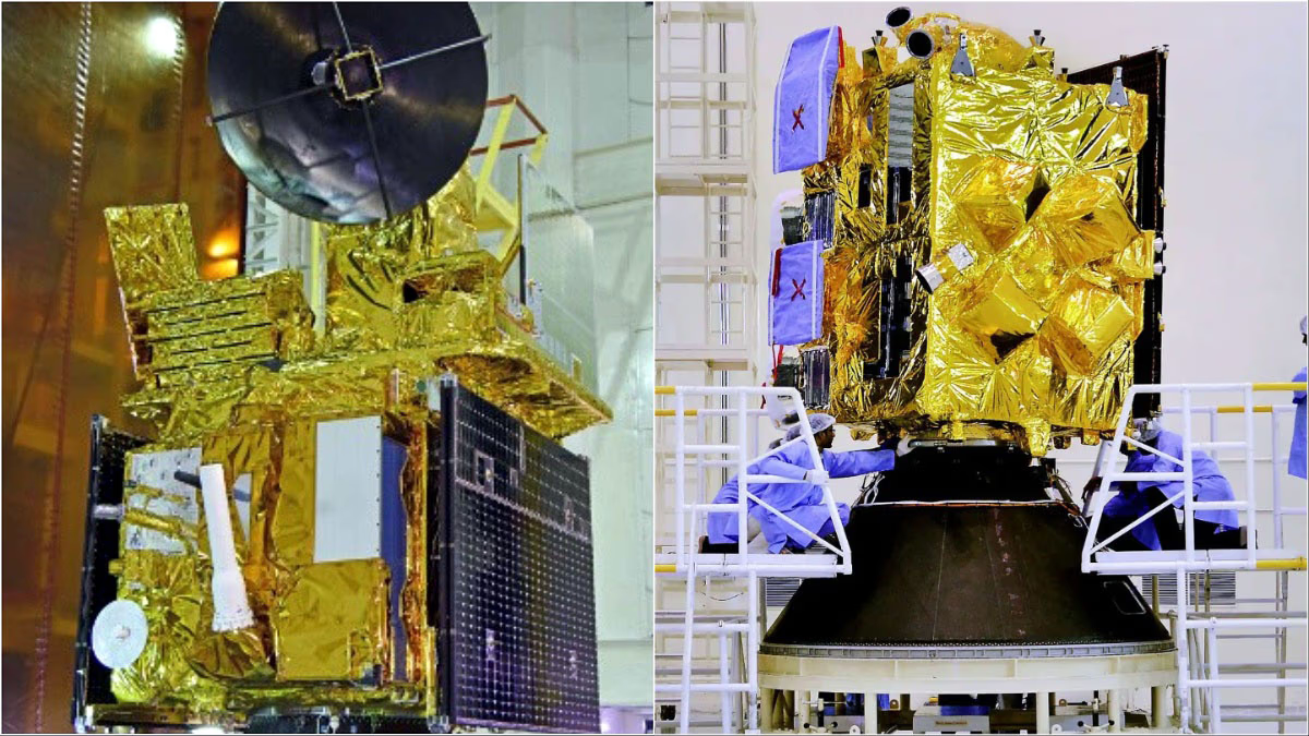
Who alerted the central government, the meteorological department, or the governments of Odisha and West Bengal? It is the nation's premier scientific organization, ISRO. Two of ISRO's satellites, EOS-06 and INSAT-3DR, have been tracking this cyclone from space. Since its formation, real-time updates have been continuously provided to the meteorological department.
Read More: Which states are affected by Cyclone Dana, and what are the preparations for dealing with the storm? Uncover 10 major insights.

Source: aajtak
What do the EOS-06 and INSAT-3DR satellites do?
The EOS-06 is equipped with an instrument called the Scatterometer sensor. It provides crucial information about oceanic winds and their circulation. As soon as the wind patterns intensify and the cyclone begins to form, it alerts instantly. This polar satellite was launched on November 26, 2022, using the PSLV-C54 rocket.
INSAT-3DR is a geostationary satellite that tracks the entire process of cloud formation. It utilizes brightness temperature to study changing weather patterns over India, determining if a storm is forming. Purpose-built for meteorological applications, it was launched on September 8, 2016.
Read More: Cyclone Live: The impact of Cyclone 'Dana' begins, with heavy rains continuing in Odisha, and landfall expected tonight.

Source: aajtak
Current status of Cyclone Dana, where is it heading?
The Cyclone Dana is set to collide with the coast on October 24. As it hits the surface, its speed may range from 120 to 130 km/hr, prompting powerful winds and heavy rain in Odisha and Bengal.
A red alert has been declared in West Bengal and Odisha by the meteorological department. Several NDRF teams remain on alert in both states in light of the cyclone's approach. Flights at Kolkata airport are suspended from this evening until tomorrow morning, and over 200 trains have been canceled. The storm's effects might even extend to Bihar and Jharkhand.


