On September 1, 2025, a devastating 6.0 magnitude earthquake shook the Nangarhar province in eastern Afghanistan, claiming hundreds of lives. According to the German Research Center for Geosciences (GFZ), the epicenter was located 27 kilometers east of the city of Jalalabad, at a depth of just 10 kilometers. The earthquake resulted in 622 fatalities and over a thousand injuries.
The United States Geological Survey (USGS) also reported a magnitude of 6.0, classifying it as a moderate yet shallow quake on the Richter scale. It struck at 11:47 PM local time, close to the Pakistan border.
Also Read:
Nangarhar Health Department spokesperson Ajmal Darwaish indicated that the deaths and injuries were predominantly in Jalalabad and its neighboring areas. A second tremor of 4.5 magnitude followed 20 minutes later, succeeded by a 5.2 magnitude jolt. Afghanistan lies in the Hindu Kush region, where tectonic plates frequently lead to earthquakes.
The Taliban government initiated rescue efforts, though accessing remote areas proves difficult. This disaster brings back memories of the 2023 earthquake with a magnitude of 6.3 that resulted in 1,500 to 4,000 deaths.
Source: aajtak
Epicenter and Magnitude
According to GFZ and USGS, the earthquake's epicenter was 27 kilometers east-northeast of Jalalabad in Nangarhar province. Its magnitude was 6.0 on the Richter scale, considered moderate, but its shallow depth of only 10 kilometers resulted in significant surface impact. Shallow earthquakes cause more destruction as the vibrations are felt directly on the ground.
The timing was crucial—Sunday night at 11:47 PM (local time)—when people were asleep. A second tremor of 4.5 followed 20 minutes later, and another of 5.2. Afghanistan, situated in the Hindu Kush mountain range, experiences earthquakes due to the collision of the Eurasian, Arabian, and Indian plates, resulting in over 100 earthquakes annually, though quakes above 6.0 are rare.

Source: aajtak
Casualties, Injuries, and Devastation
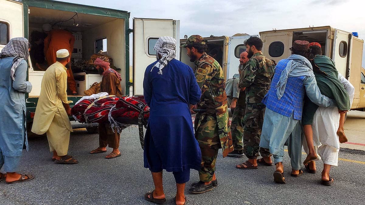
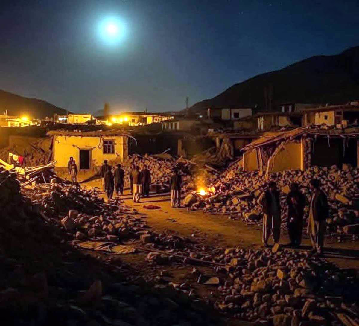
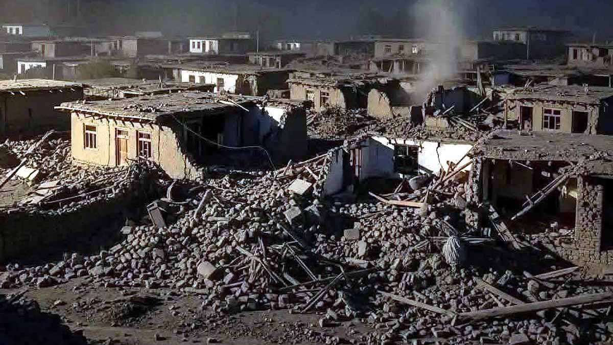
Nangarhar Health Department spokesperson Ajmal Darwaish confirmed that hundreds have perished, mostly in house collapses. Initial reports stated that mud houses in Jalalabad and surrounding villages crumbled.
Also Read:
Injured individuals have been admitted to local hospitals. Mild tremors were felt in Kunar province too, and proximity to the Pakistan border led to tremors there as well, but without damage. Afghanistan's rugged terrain complicates rescue operations.
The Taliban government dispatched relief teams, while the UN and other agencies offered assistance. In 2023, an earthquake resulted in 1,500-4,000 deaths, a figure potentially exceeded by the current shallower depth quake's impact.
Source: aajtak
Seismic History: Why Frequent Tremors?
Afghanistan's location in the Hindu Kush region places it in an active tectonic zone where the Indian plate collides with the Eurasian plate at a rate of 39 mm/year. Over the past decade, ten earthquakes above magnitude 6.0 have occurred within a 300 km radius. The 2015 earthquake with a magnitude of 7.5 was the deadliest. The 2023 earthquake with a magnitude of 6.3 claimed 1,500 lives. Eastern provinces like Nangarhar and Kunar, near the Pakistan border, are along active fault lines. Climate change has increased landslide risks.