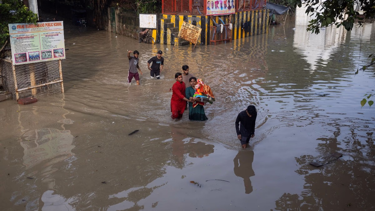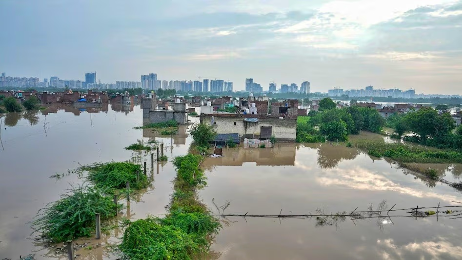
Numerous areas in Delhi and NCR are submerged in water. Social media is awash with photos and videos of flooded streets, submerged cars, and homes awash with water. While the surge in the Yamuna is the primary cause of flooding in Delhi, poor drainage is being blamed for Gurgaon's water woes.
Yamuna Water Level Above Danger Mark
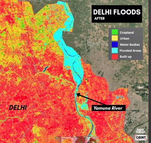
The Yamuna River in Delhi has reached its third-highest level in six decades. At 8 AM on Thursday, the water level of Yamuna was recorded at 207.47 meters, significantly above the danger mark of 205.33 meters. The previous day, heavy rains raised the Yamuna to a record 208.66 meters. Satellite images reveal that in some areas, the Yamuna River has spread over 7 kilometers beyond its embankments.
Source: aajtak
Lower Areas Submerged, Rescue Operations Underway
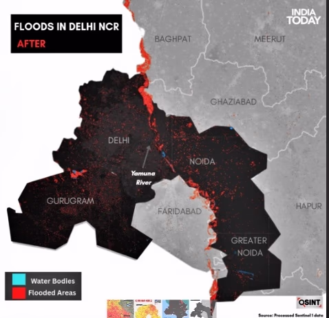
The overflowing Yamuna River has inundated several low-lying areas in Delhi. Satellite analysis indicates that neighborhoods like Geeta Colony, Mayur Vihar Phase I, Yamuna Bazaar, Ring Road (toward Wazirabad), Civil Lines, Sonia Vihar, Kashmiri Gate, Bawana, Mukundpur, Sarita Vihar, and Janakpuri are at risk of being underwater. Residents in Yamuna Bazaar were seen wading through knee-deep waters to reach safety. Those living in vulnerable areas have been evacuated to safer locations.

Source: aajtak
Waterlogging Issues Persist in Gurgaon
Heavy rain in Gurgaon has caused widespread disruption alongside Delhi. A brief 100 mm downpour within four hours led to traffic jams and waterlogged streets in Gurgaon, particularly on NH-48. Poor drainage and rainwater management have been cited as reasons for Gurgaon's plight. Satellite images also depict flooding near Palam, Udyog Vihar, and around the Najafgarh Lake.
Source: aajtak
IMD Had Warned of Heavy Rain
The Indian Meteorological Department (IMD) predicted light to moderate rainfall for Delhi-NCR and parts of Haryana from September 1 to 3. On September 3, heavy to extremely heavy rainfall (64.5-204.4 mm) continued in parts of Haryana, Punjab, and western Himalayan region, escalating the threat of flooding and waterlogging in low-lying areas.