Introduction - In Delhi, Yamuna has crossed its danger mark. But to call it a disaster, one must overlook the negligence during the establishment of settlements along the riverbanks. Satellite images reveal that despite the floods, Yamuna stays within its bounds. The crossings are due to human needs and governmental carelessness.
In the rainy season, a river's swelling is natural; however, human encroachments have given rise to what we call a flood, now termed a disaster. Let us explore the Yamuna's flow in Delhi to understand if it's truly at fault, or whether we have contributed to the issue ourselves.
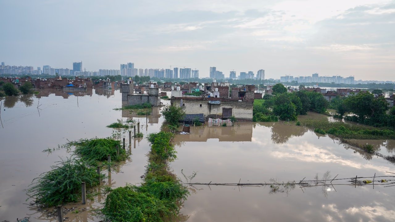
Satellite images depict how human settlements have suffocated Yamuna in Delhi. All civilizations were born along rivers, yet they maintained a safe distance. Taking examples from Delhi, its oldest settlements were at least 5 km away from Yamuna. Ancient Mehrauli is 20 km away, 700-year-old Palam 25 km from Yamuna, while Tughlaqabad lies 5 km away. Mahipalpur too is one of the older settlements, at a 15 km distance. Clearly, the early settlers understood Yamuna's flow. However, as human needs grew, the gap between Yamuna and settlements narrowed. Today, flood-stricken areas are essentially extensions of the riverbed, as seen in satellite images.
The extent of flooding in Yamuna is known as soon as water is released from Haryana's Hathnikund Barrage. However, Delhi's flood control involves barrages at Wazirabad, ITO, and Okhla. Let us observe how Yamuna behaves normally in these areas, and the current flood situation around them. Moreover, let's determine whether unexpected flooding extends to surrounding areas.
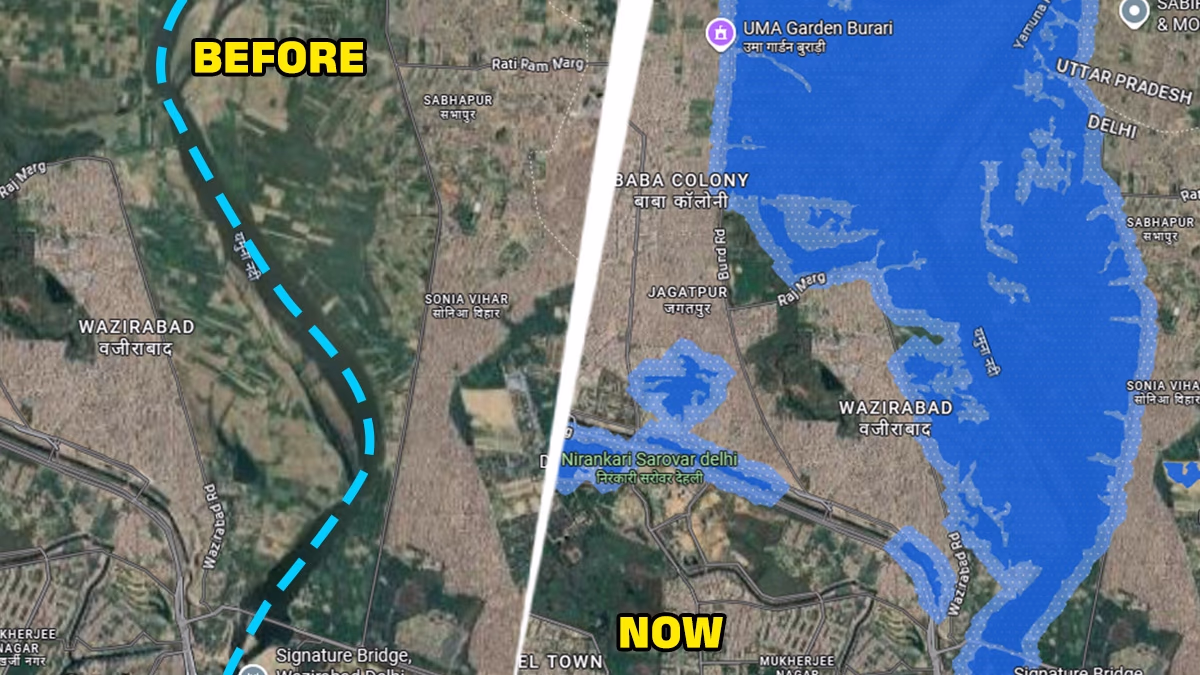
The flow from Hathnikund Barrage is halted at Wazirabad before entering Delhi. Even above the danger line, Yamuna strives to flow between Wazirabad and Sonia Vihar. Yes, water has entered areas close to Yamuna, but none extend beyond a kilometer from the river's midpoint.
Source: aajtak
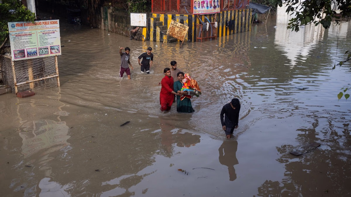
If Yamuna crosses the danger mark, water can reach 2 km away to Bhajanpura and Jagjivan Ram Nagar, making it common for water to infiltrate settlements like Majnu ka Tilla and Kashmiri Gate along the riverbanks.
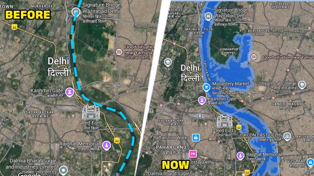
The Monastery Market in these Civil Line areas was built within Yamuna's bounds. Thus, if water enters, the market constructors, not the river, are to blame. A similar situation is occurring in Gandhinagar, Shastrinagar, and Laxminagar's low-lying areas along Yamuna.
Source: aajtak
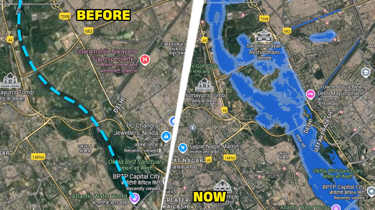
This area sees Akshardham Temple's vicinity submerge every monsoon. This time, with increased water levels, some Mayur Vihar areas face inundation threats. Rest assured, the issue arises mainly for colonies and slum settlements developed at lower levels.
Source: aajtak
Overall, from Wazirabad to Okhla Barrage, Yamuna's 25 km journey poses a monsoon challenge for Delhi. However, these issues occur primarily in riskily placed areas near Yamuna. One must question why these settlements weren't prohibited at their inception. The answer lies in people's compulsion and political interests. Delhi's flood disaster is a man-made issue, not Yamuna's fault.
Why Risk Lives Despite Knowing The Danger?
To clarify, a river's danger mark is set based on its normal flooding reach during the rainy season, determined over years of flood studies. This level serves as a gauge for relief efforts in surrounding areas. When Yamuna's water level reaches 205.33 meters, a flood warning is issued. This time, the water rose to 207.41 meters, surpassing the danger mark by 2 meters. So, who is to blame for settlements overlooking this danger mark?
If Yamuna Swells in Delhi, Give It Space to Breathe
Yamuna was a significant topic in Delhi elections, with pollution cleanup as a challenge. Whether achieved or not, rivers naturally cleanse themselves during high flows. Authorities should ensure Yamuna's silt removal and retain its depth. The river provides ample opportunities for this year-round. Moreover, the government should daringly make permanent alternative arrangements for slum settlements along Yamuna's banks.
For Delhi, Yamuna is a boon, yet it is either remembered for pollution or monsoon floods. The shortcomings lie in governmental arrangements.