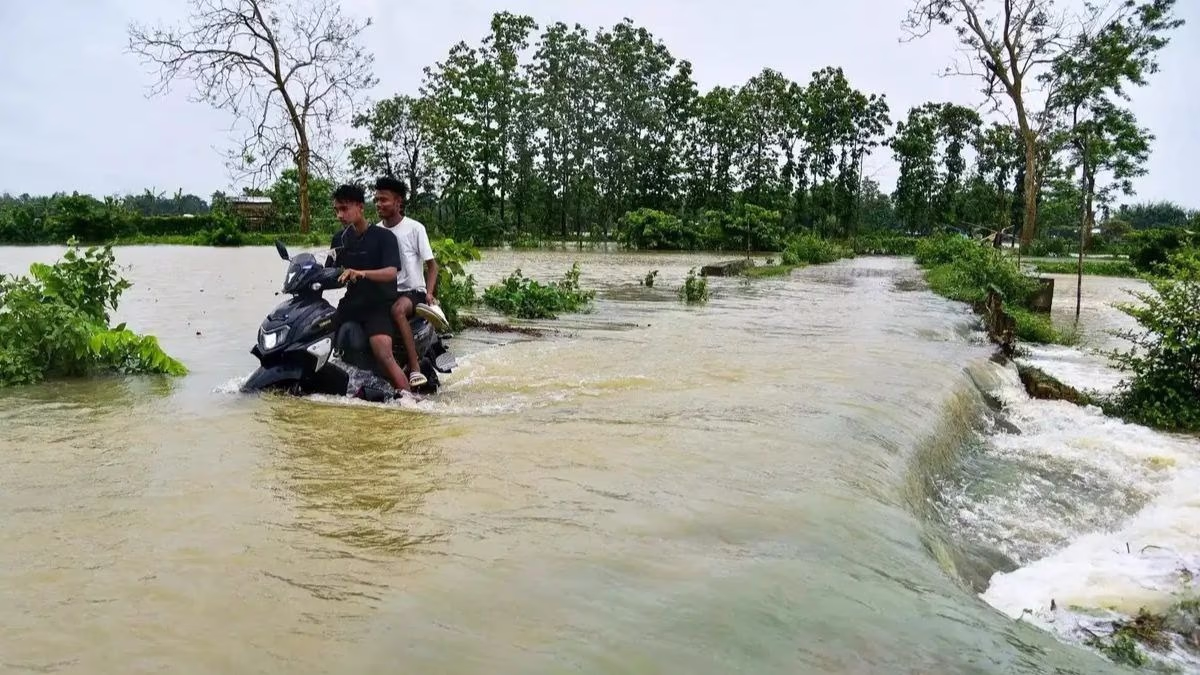
The monsoon has once again submerged vast regions of India. Uttar Pradesh, Uttarakhand, Assam, and Bihar are battling the ravages of relentless rains; however, Bihar faces the most dire circumstances. The heavy downpour has impacted nearly 1.7 million people across 10 districts in Bihar, as overflowing rivers and breached embankments seem to have put a halt to life here.
Source: aajtak
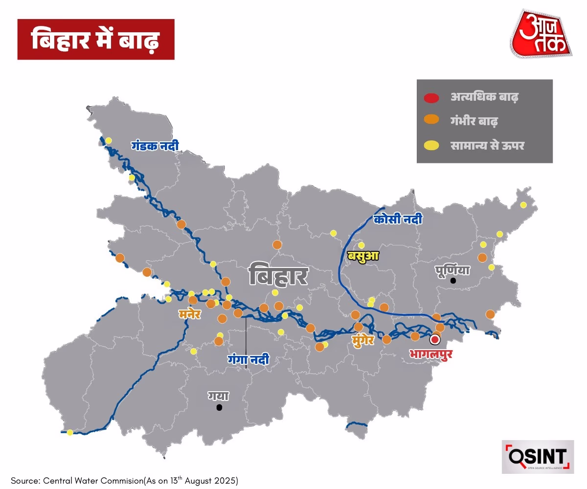
Districts like Bhojpur, Patna, Bhagalpur, Vaishali, Lakhisarai, Saran, Munger, Khagaria, Supaul, and Begusarai are experiencing rivers and canals filled to the brim, submerging roads, villages, and homes. Bhagalpur district is notably struggling, with six blocks—Kursela, Barari, Manihari, Amdabad, Mansi, and Pranpur—caught in the grip of the floodwaters. Approximately 500,000 people are grappling with the havoc outside their homes.
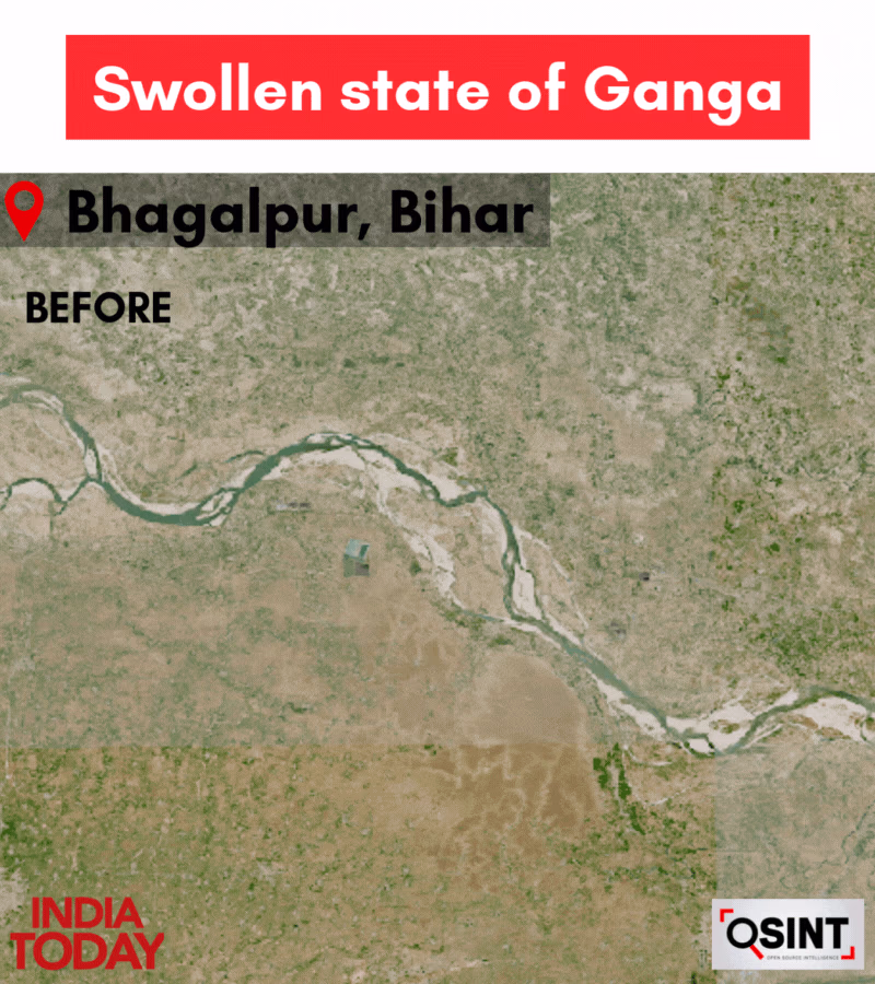
According to Central Water Commission (CWC) data, the Ganga river level at Bhagalpur station has surged to 34.86 meters, matching the high flood level and exceeding the 33.68-meter danger threshold. The conditions at neighboring Kahlgaon and Ekchari stations are equally precarious.
Source: aajtak
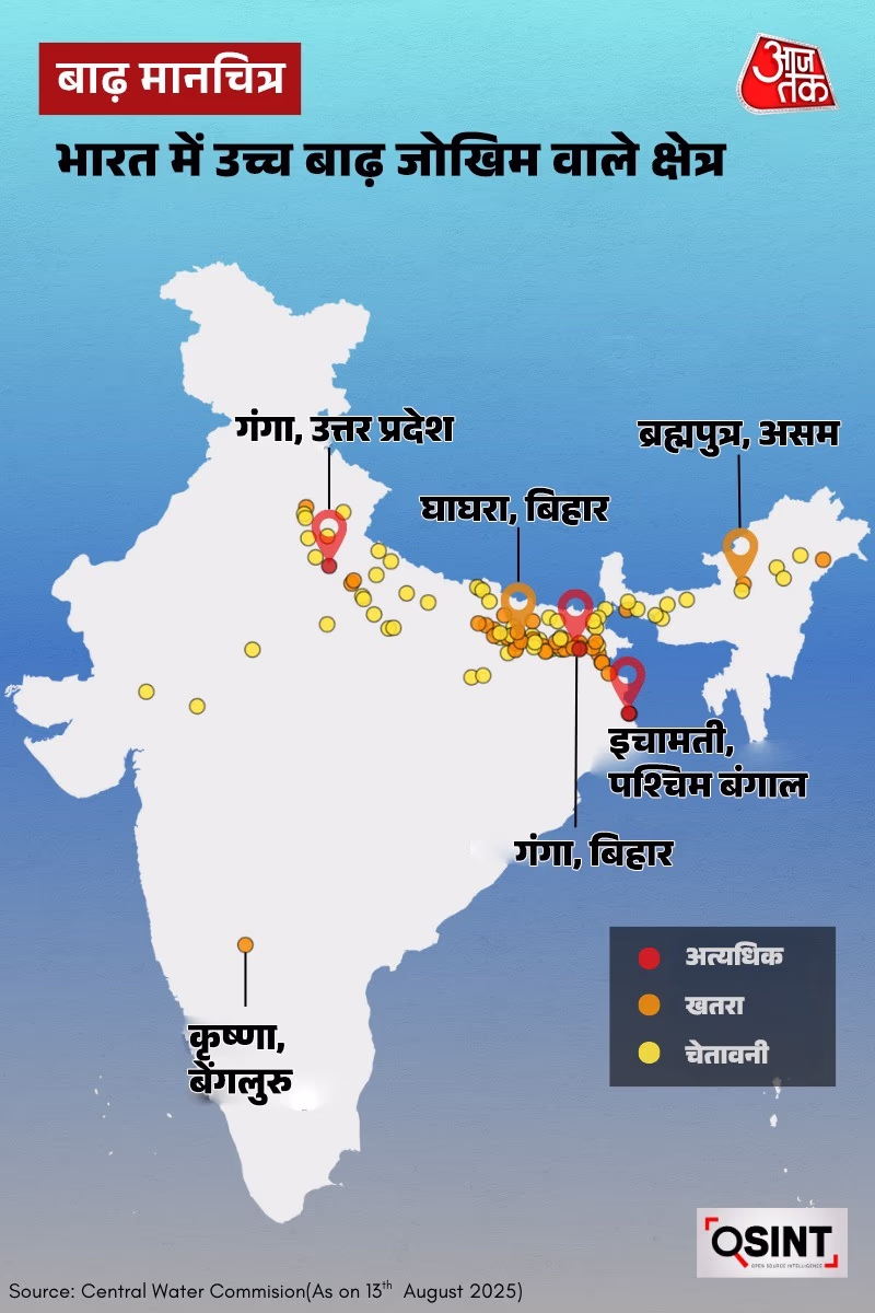
The Aaj Tak OSINT team performed an analysis on the CWC's latest flood data alongside remote sensing imagery, assessing the nationwide flooding scenario. Rivers like the Ganga in Uttar Pradesh and Ghaghara in Bihar, Ichamati in West Bengal, and Brahmaputra in Assam are flowing above danger levels. The Ichamati river in West Bengal has surpassed the danger mark in two locations. Sentinel-2 satellite data provided accurate mapping of the flood-affected regions in Bihar, illustrating the rivers' menacing presence above danger levels.
Source: aajtak
Sentinel-2 images highlight the Ganga's journey through Akbarnagar, Tilakpur, and Belthu near Bhagalpur, breaking embankments and spreading about 19 kilometers wide. Villages and farmlands have been inundated with water.
Source: aajtak
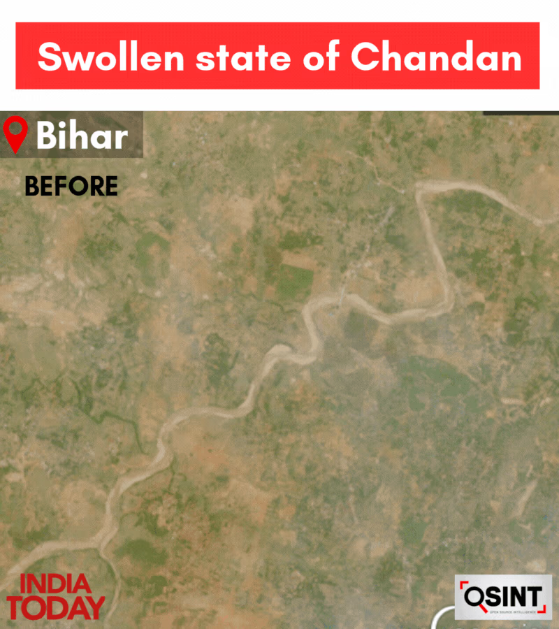
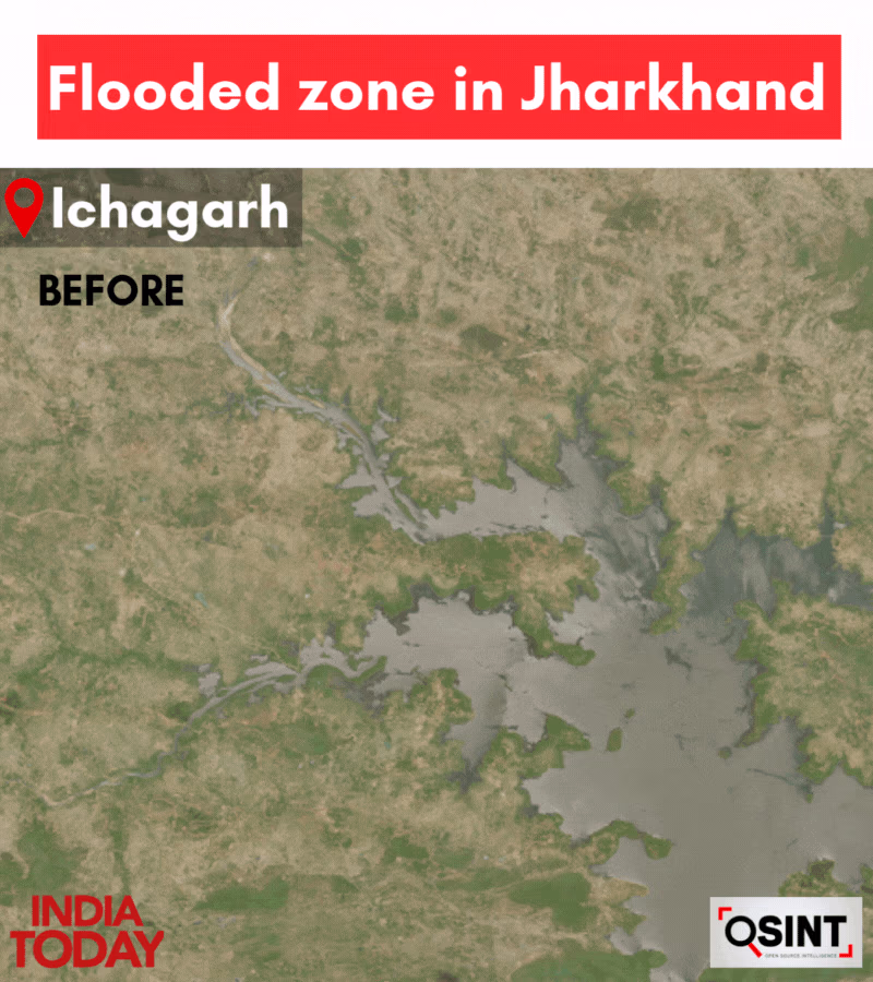
Flood mapping of the Chandan region in Bihar and the Ichagarh area in Jharkhand reveals vast stretches submerged under water.
Source: aajtak
The flooding in Jharkhand's Sahibganj district has resulted in the Ganga surpassing danger levels, affecting nearly 20,000 people across five blocks as their homes are engulfed by water. The Indian Meteorological Department (IMD) notes that from June 17, Jharkhand has seen 40% more rain than usual.

Source: aajtak
According to CWC statistics, the Teesta in Sikkim and West Bengal, Yamuna in Uttar Pradesh, and Chandan river in Bihar are flowing at elevated levels. The IMD has issued a red alert for Sikkim, Assam, and Meghalaya, and an orange alert for Bihar, Himachal Pradesh, and Arunachal Pradesh.