In Bangladesh, clouds of crisis loom over the interim government of Mohammad Yunus, with the army gearing up for a coup. Recently, Yunus mentioned India's Siliguri Corridor, also known as the 'Chicken Neck.' Though he may have boasted about it during his China visit, this has unwittingly exposed Bangladesh's vulnerabilities, for the country possesses not one but two such chicken necks.
Yunus's Statement Sparks Controversy
During his visit to China, Mohammad Yunus described India's northeastern region as 'landlocked,' arguing that with no links to the sea, Bangladesh stands as the area's sole maritime guardian. His comments reignited the Chicken Neck debate, prompting warnings from Assam's Chief Minister Himanta Biswa Sarma. Sarma stated Bangladesh's two chicken necks are more sensitive and vulnerable.
Read more about Bangladesh's twin chicken necks and Himanta's warning to Yunus.
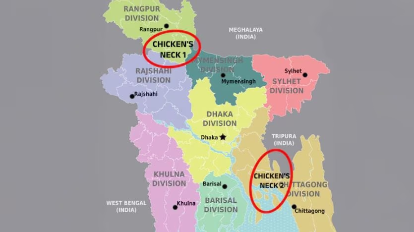
Presenting a contrast, the Chicken Neck of India, according to Army Chief General Upendra Dwivedi, isn't a weakness but a strength. The Siliguri Corridor forms a robust link for India with strategic military positioning on three sides. On the contrary, the two chicken necks in Bangladesh, referenced by Himanta, are notably fragile. The question arises: where exactly are these two chicken necks in Bangladesh located?
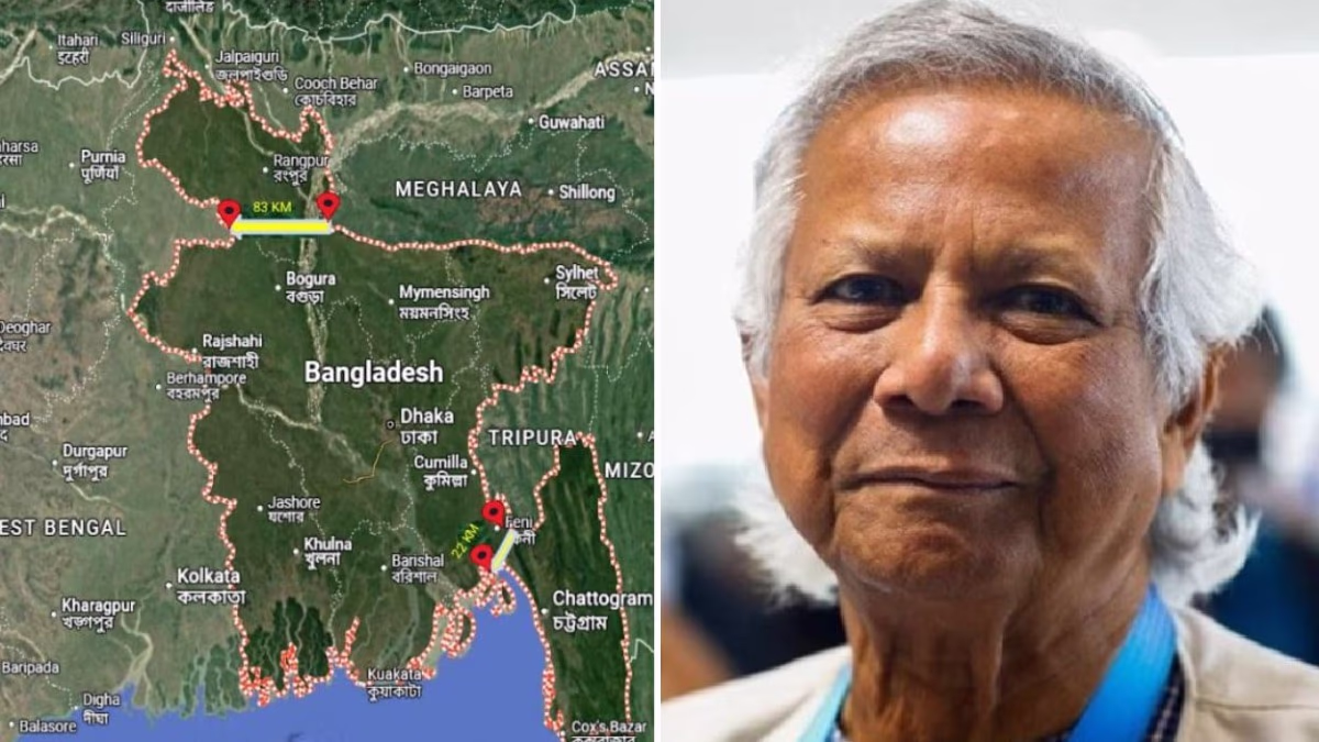
North Bangladesh Corridor
The North Bangladesh Corridor runs as a strip of land approximately 80 kilometers in length between West Bengal and Meghalaya. This slender land point connects the South Dinajpur district of West Bengal with the South West Garo Hills district of Meghalaya. North of this strip lies Rangpur, a pivotal administrative division that isolates this section of Bangladesh, rendering it a vulnerable chokepoint.
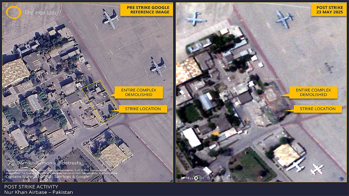
Source: aajtak
Bordered by West Bengal, Assam, and Meghalaya, Rangpur expands over 16,000 square kilometers, housing a population of about 17.6 million. Here, Muslims make up 86.5% of the population, followed by Hindus at 13%, with the remainder comprising Christians and Buddhists.
Chittagong Corridor
The other chicken neck mentioned by Himanta in his post is the Chittagong Corridor. This strip spans 28 kilometers and connects South Tripura to the Bay of Bengal. It divides Bangladesh’s Chittagong Division into two parts: the northwest with six districts including Brahmanbaria, Comilla, Chandpur, Lakshmipur, Noakhali, and Feni.
The southwest comprises districts like Chittagong, Khagrachari, Rangamati, Bandarban, and Cox's Bazar. The sensitivity here stems from its isolation, accessible only via sea.
Himanta's Standing Warning
Himanta emphasized the geographical facts some tend to forget, asserting the precarious nature of Bangladesh's narrow corridors, similar in importance to India’s Siliguri Corridor. Previously, he remarked India's possession of one chicken neck versus Bangladesh's two.
He also issued a cautionary note stating, should Bangladesh attack India's chicken neck, India will reciprocally target Bangladesh's two. Linked to Chittagong Port, Bangladesh's chicken neck is even narrower than India's and nearly within stone-throwing proximity.
Learn more about Yunus's view on the 'landlocked Seven Sisters' and Chicken Neck as an opportunity for China.
In essence, a Chicken Neck signifies a slender land path crucial for connectivity, potentially serving as a chokepoint. India's Siliguri Corridor, 22 kilometers wide, links it to northeastern states, making it one of South Asia's most monitored corridors.