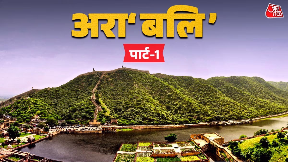
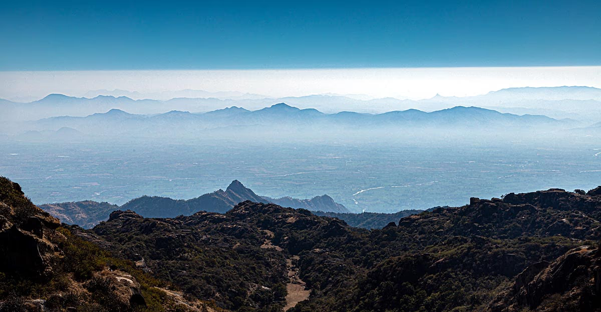
Spread across the Indian subcontinent, the Aravalli mountain range is not just a geographical wonder but is amongst the world's oldest mountain ranges. This chain spreads across Rajasthan, Haryana, Gujarat, and Delhi, stretching roughly 670 kilometers long, and its history is intertwined with the early days of Earth.
According to scientists, the Aravalli Range was formed in the Proterozoic era, which started approximately 2.5 to 3.5 billion years ago. Not only do these mountains influence India’s climate and environment, but they also play a critical role in halting the spread of the Thar Desert.
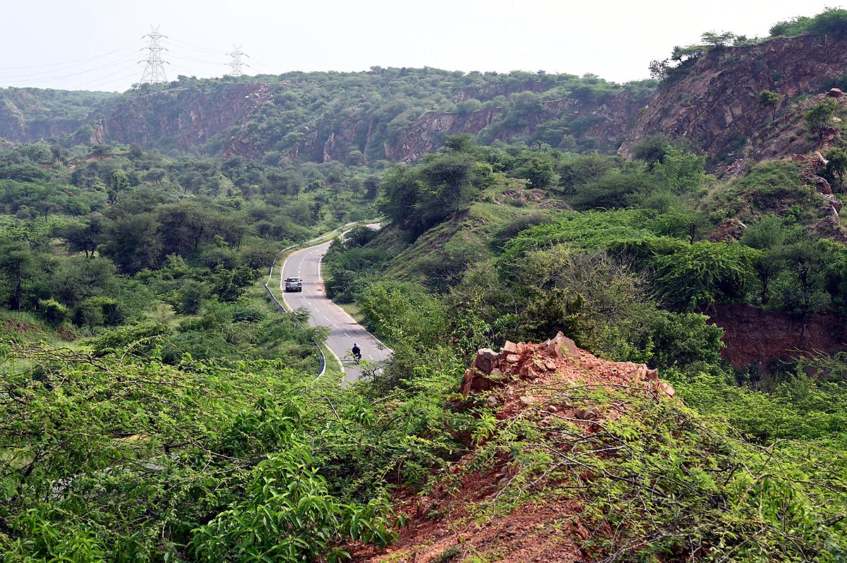
The Aravalli range winds through northwestern India, beginning from Palanpur in the southwest of Gujarat and extending to Delhi. Its elevation varies from 300 to 900 meters on average, peaking at 1,722 meters at Guru Shikhar in Mount Abu, Rajasthan's only hill station.
Source: aajtak
Deriving its name from the Sanskrit word 'Aravali,' meaning 'line of peaks,' this range acts as a natural barrier of India, preserving northern India from the advancing desert and shielding it from dry and hot winds.
Geologically speaking, Aravalli is one of the oldest mountain ranges in the world. While the relatively young Himalayan range is around 50 million years old, the Aravalli tells a tale stretching back over 2.5 billion years. They were born during the Proterozoic era when significant transformations in the Earth's crust were taking place.
Check this:
The Aravalli range is not only a testament to geological history but is also abundant in minerals and serves as the origin for several rivers like the Luni, Banas, and Sabarmati. Its forests are rich in biodiversity, home to rare plants and animals.
The contributions of the Aravalli span multiple dimensions. This range maintains environmental balance, aids in water conservation, and is economically valuable due to minerals like marble, zinc, and copper found here. However, illegal mining and urbanization are threatening its stability today.
The formation of the Aravalli Mountain Range is the result of a complex geological process known as orogeny, typically involving collisions of Earth's tectonic plates leading to mountain formation. The creation of Aravalli is unique due to its ancient origins during the Proterozoic era (about 2.5 billion to 540 million years ago). Its main formation took place around 1.8 billion years ago from the collision of ancient cratons (stable pieces of Earth's crust).
Earth’s crust is divided into multiple plates that float atop the mantle (Earth's second layer). These plates gradually move, shifting only a few centimeters every year. When two plates collide, the crust buckles and rises to form mountains. In the case of Aravalli, its genesis was due to the collision of three significant cratons—Bundelkhand Craton, Rajasthan Craton, among others, known collectively as the 'Aravalli-Delhi Orogeny.'
Source: aajtak
Proterozoic times saw continents appear separately on Earth. The Aravalli formation commenced as marine-bed rocks, like volcanic and carbonate rocks, and granite came under pressure in a 'eu-geosyncline' (marine trough). This 'Bandiced Gneiss Complex (BGC),' completed approximately 2.5 billion years ago, is its core.
Main Orogeny occurred about 1.8 billion years ago, but its evolution began 300 million years earlier. Lead isotope data estimates mineral districts' ages based on 36 samples.
Suddenly, 700 pits appeared in Turkey... The Entire Region Sinking into the Abyss, Photos
This range has existed for approximately 2.5 billion years, yet its height has dwindled due to continuous erosion. Today's mountains are ancient and eroded but still reveal stories in their rocks.
Tectonic Plate Theory suggests convection currents (heat-induced flows) within the Earth’s mantle cause plates to move. When plates collide, subduction (one plate goes under another) or collision occurs. In the Aravalli case, a collision formed fold mountains. This slow process took millions of years, influenced by volcanic activity and metamorphism (change in rock form).
Source: aajtak
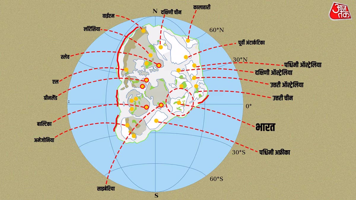
At Aravalli's formation, today’s India wasn't recognizable. The Proterozoic era was marked by continental separation and formation of supercontinents. The Indian subcontinent then formed part of 'Columbia,' existing from 1.8 to 1.5 billion years ago.
Ancient geography reveals Indian cratons (like Dharwar, Bundelkhand, Aravalli) moving north-south and east-west. The Satpura Mobile Belt, between Bundelkhand and Bhandara Cratons, witnessed collisions. At that time, India was near the equator but precise lat-long comes from paleomagnetic data. Studies show Dharwar and Bundelkhand Cratons were in the southern hemisphere.
What was India like?...
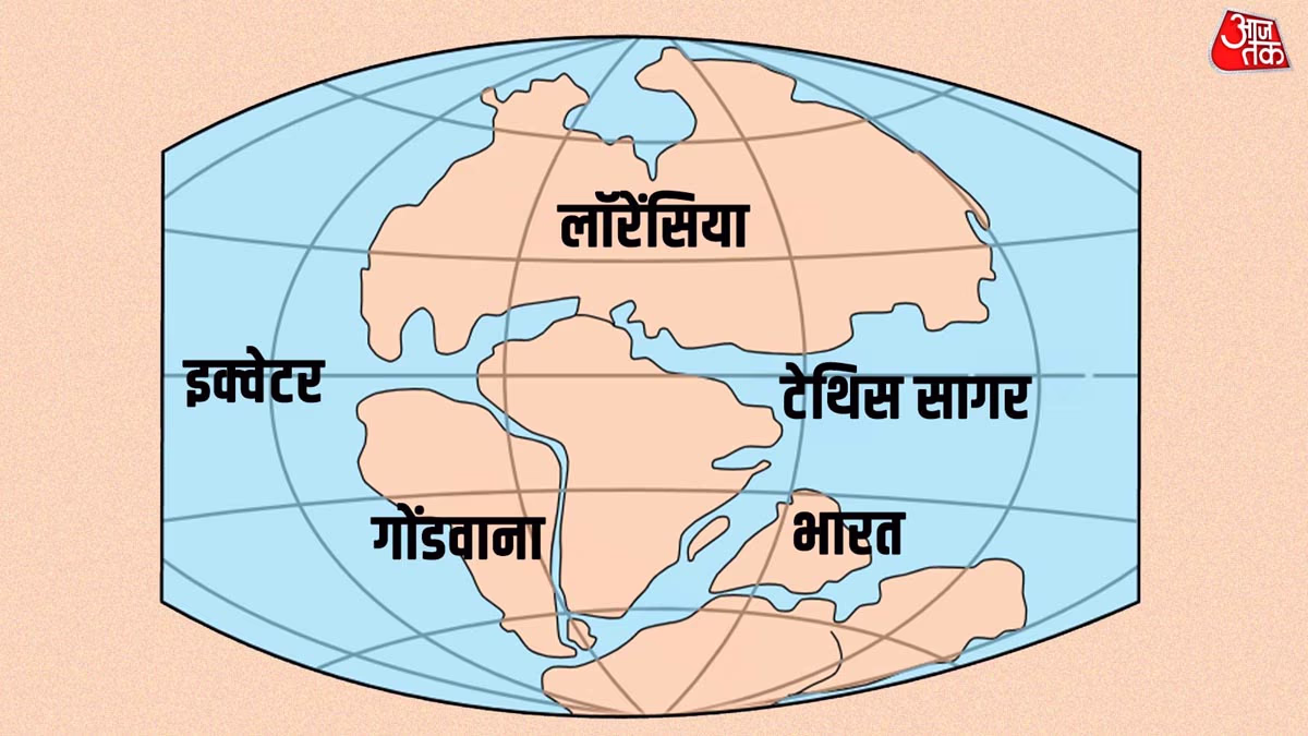
During this time, life on Earth mainly thrived in oceans—bacteria, algae. On land, there were no plants or animals. Climate was warm and humid due to scarce atmospheric oxygen. Oceans had iron-rich waters forming banded iron formations. Marine troughs existed in the Aravalli region, creating pressure that led to the formation of mountains. At that time, India was a small continent later joining Gondwana.
Source: aajtak
Some 1.8 billion years ago, the Aravalli basin transitioned from a passive margin to an active one, teeming with tectonic activity. Volcanic eruptions were common then. Earthquakes were frequent. India was vastly different—no Himalayas, no Ganges Plains.
The Aravalli's input isn't merely aesthetic but also serves significant scientific and practical purposes. First of all…
Environmental Contribution:
Known as 'India's Natural Green Wall,' it blocks the eastern spread of the Thar Desert. Without it, Rajasthan and Haryana would be far drier. It influences monsoon winds, increasing rainfall.
Water Conservation:
The Aravalli is the source of several rivers vital for agriculture and drinking water. Scientifically, it aids in the water cycle—the rainwater seeps into rocks and becomes groundwater. Hence, it acts like a natural sponge, channeling rainwater into the earth.
Learn more:
Mineral Contribution:
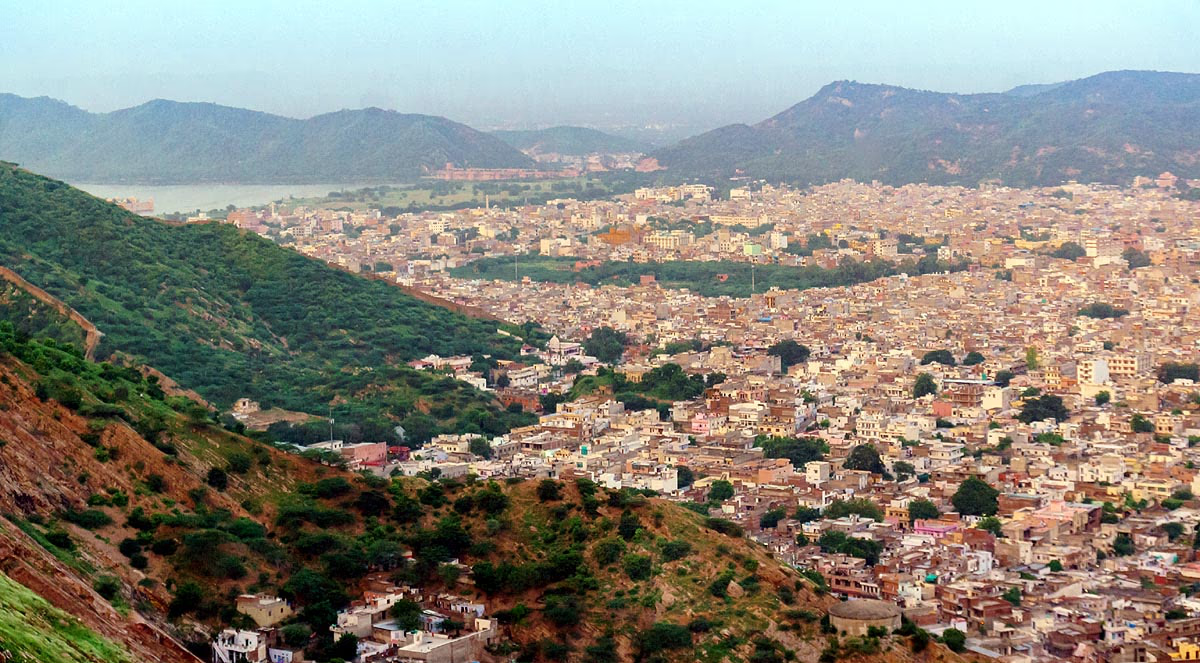
The Aravalli is teeming with minerals—zinc, lead, copper, silver, and marble abound. Mining thrives in Udaipur and Rajsamand regions.
Biodiversity:
It's an ecological hotspot hosting over 300 bird species and animals like leopards, sloth bears. Plant species include neem, acacia, and dhok. Scientific studies reveal it guards ancient flora and houses an extensive corridor for wildlife.
Source: aajtak
Cultural and Historical:
Aravalli is home to ancient forts and temples, tightly entwined with Rajput history. Its rocks are invaluable for studying Earth’s history.
Economic Contribution:
Mining provides employment, yet environmental damage persists. Scientists emphasize sustainable development is needed.
Today, the Aravalli Range faces threats from illegal mining, destroying 20% of its region. Climate change leads to declining rainfall. The Governing body's Aravalli Green Wall Project aims at conservation. Scientists have long suggested safeguarding and expanding forests here is imperative, and controlling mining is vital.
The Aravalli is an ancient Indian heritage formed by tectonic collision, standing for 2.5 billion years when India was part of a supercontinent. Its contributions span environment, economy, and science. Protecting it is crucial. If lost, Delhi-NCR could swiftly turn into a desert.