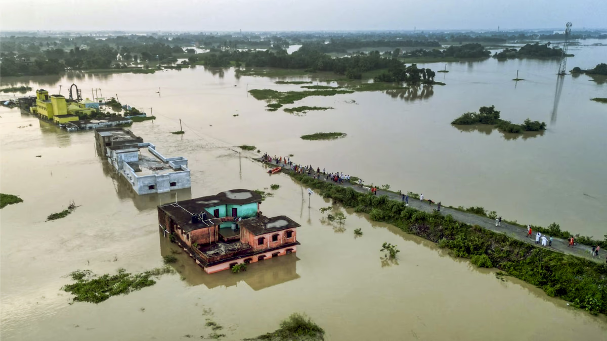
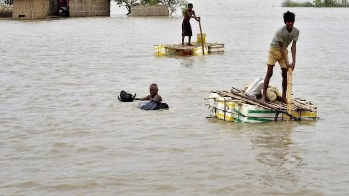
The flood situation remains critical in half of Bihar's districts. The water levels of major rivers are still flowing above danger marks in most places. The fierce form of rivers like Kosi, Gandak, Bagmati, Mahananda, and Ganga can be witnessed here. Among them, the Kosi River is causing the most havoc, having changed its course by around 120 km over the past 250 years. Flood control plans in the state have consistently been ineffective.
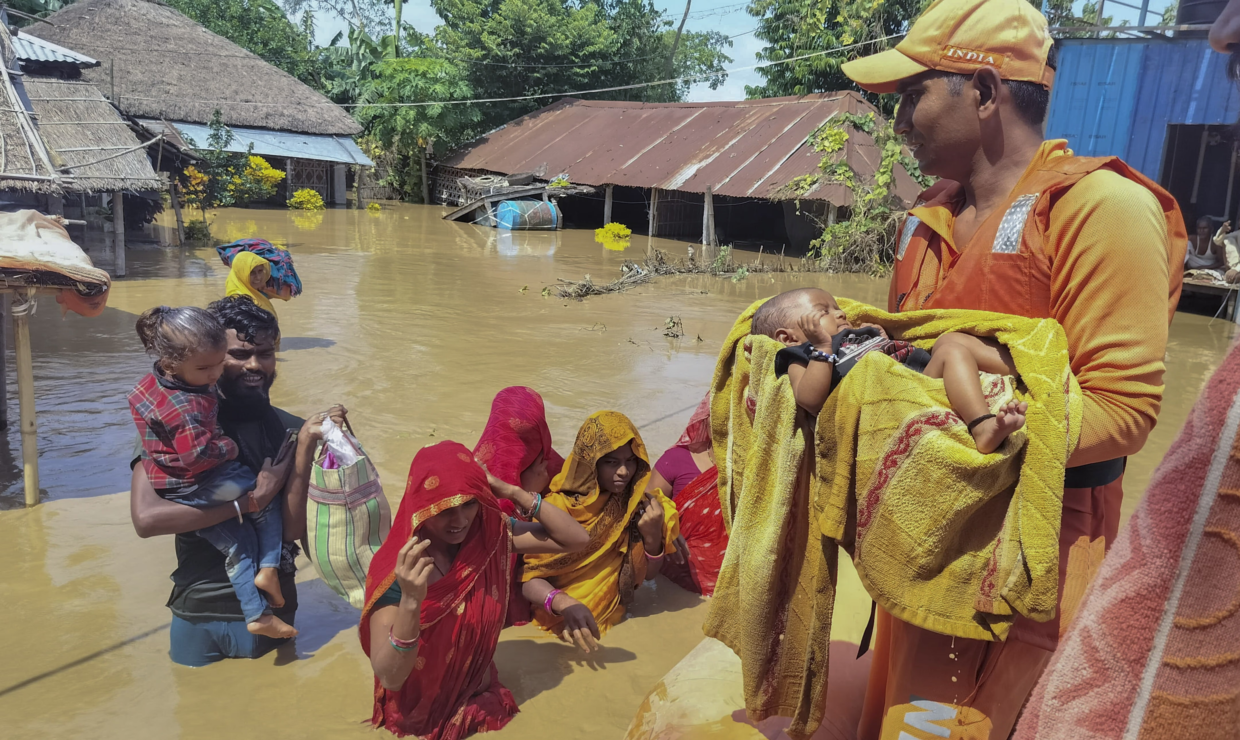
According to the state disaster management department, 17 districts, including East and West Champaran, Araria, Kishanganj, Gopalganj, Sheohar, Sitamarhi, Supaul, Madhepura, Muzaffarpur, Purnia, Madhubani, Darbhanga, and Saran are floods. Relief materials are being dropped via Indian Air Force helicopters; 33 NDRF and SDRF teams are engaged in relief and rescue operations, and approximately 975 boats are operating in the affected regions. The Water Resources Department is implementing flood safety measures.
Flood Strikes Areas Near Embankments Annually
The Kosi River, flowing from the high Himalayas, constantly expands carrying sediments like sand, gravel, and stones. Both Nepal and India have constructed dams on this river. It serves as the cradle of culture for the Mithila region of North Bihar. Areas near the embankments in Supaul, Araria, and Saharsa face floods annually, causing immense damage and loss of lives. Flooding occurs when embankments give way under increased water flow.
Kosi River Has Altered Its Course by 120KM in 250 Years
In the past 250 years, the Kosi River has shifted its path by approximately 120 kilometers. This river's unpredictable course change makes it the 'Sorrow of Bihar.' The river carries large amounts of silt, which settles on its bed, causing the water level to rise and resulting in the river changing its course and wreaking havoc in new areas.
Read More:
The history of the Kosi River shows its gradual movement westward. During the 18th century, it flowed near Munger and Bhagalpur, but now it moves through eastern Bihar from Nepal. This unpredictable flow contributes to annual flooding issues, impacting millions. Embankments and dams were built to control this, but these measures often fall short given the river's nature.
What Are the Flood Control Measures on the Kosi?
Numerous flood control measures have been proposed and implemented on the Kosi River, yet their effectiveness has been limited. The main strategy has been constructing embankments. Initiated in the 1950s with cooperation from India and Nepal, the Kosi project built embankments on both riverbanks to regulate flow and protect flood-prone areas. However, embankment failures, such as the Kosi embankment breach in 2008, have highlighted the limitations of these plans.

Source: aajtak
The Kosi Barrage, constructed in Nepal, aims to control the water flow and provide both irrigation and flood control. Although effective in water management, excessive rainfall often exceeds its capacity, perpetuating the flood problem.
The Kosi High Dam in Nepal remains an unrealized dream for Bihar, with 38 years having passed without a detailed project report. The plan between India and Nepal to build an Upper Kosi High Dam aims for large-scale water storage and flood control, though it remains unimplemented, it could potentially help manage the river's water levels.
Read More:
Reasons for Kosi's Course Change?
Massive silt deposits cause the Kosi River to raise its bed and increase flood risks. This accumulation makes the water shallow, raising the water level, prompting the river to seek new paths. The rate of silt accumulation is significant enough to alter the river's course yearly, necessitating channels and special projects for silt management to streamline the river's flow, which remains a considerable challenge.
The majority of the Kosi River's flow traverses Nepal, stressing the need for coordination between India and Nepal for flood control. Both nations need regular meetings and better resource management cooperation. Nonetheless, more concerted efforts are needed in this sector.
The Kosi River, emerging from the Himalayas, passes through a geologically active area, where tectonic activities alter the landscape, affecting river flow. As tectonic plates rise or fall, the river's course shifts, leading to flooding situations.

Source: aajtak
A natural process called avulsion, where the river leaves its main channel and makes a new one, is common in the Kosi, especially during floods. When the pressure in the old path eases, the river seeks a new course, keeping its flow dynamic.
The catchment area of the Kosi is in Nepal, where rapid flows from the hills can cause new channels when heavy rains or melting glaciers increase water pressure, leading to river course changes.
Read More:
Structures like embankments and dams can disrupt the natural river flow. The structures on the Kosi are often not effective in controlling the river's water flow and sometimes cause channel changes themselves. If embankments break, the river finds a new path, significantly altering its flow.
How Have All Flood Control Plans Failed?
Several reasons underlie the failures of flood control plans, including administrative, technical, and natural elements. Embankments were constructed in Bihar for flood control, but many became weak due to poor maintenance, leading to large-scale floods. For example, embankments on the Kosi River often broke, causing severe flooding situations. Long-term neglect diminished their impact.
Flood control plans were weak from scientific and technical perspectives. The design of embankments did not account for the region's geography and Kosi's unpredictable streams, resulting in unsuccessful control over river flow.
Bihar's flood control heavily relied on embankments, with less focus on water storage, canal expansion, and vegetation protection. Villages near embankments became vulnerable as structural weaknesses often led to breaches, worsening the flood situation.
Climate change has led to irregular rainfall and unexpected weather changes, exacerbating flood severity. Nepal’s mountain-fed rivers greatly impact Bihar's river systems, yet there’s no concrete plan for controlling sudden incoming water from Nepal.
The lack of proper coordination between Bihar and Nepal for flood control is another significant reason. Rivers like Kosi and Gandak originate in Nepal, necessitating an effective bilateral flood control policy, which has not been successful so far.
Bihar's weak drainage system causes water logging during rains. Insufficient water drainage exacerbates flood situations. Plans lack adequate drainage provisions, proving a significant shortfall in flood control strategies.


