
India is a nation where natural disasters like earthquakes and tsunamis occasionally strike havoc. The 2004 tsunami taught us the vital lesson that timely warnings can save lives. Fueled by this realization, India devised a specialized warning system for earthquakes and tsunamis, crucial for ensuring our safety.
Why Is an Early Warning System Crucial in India?
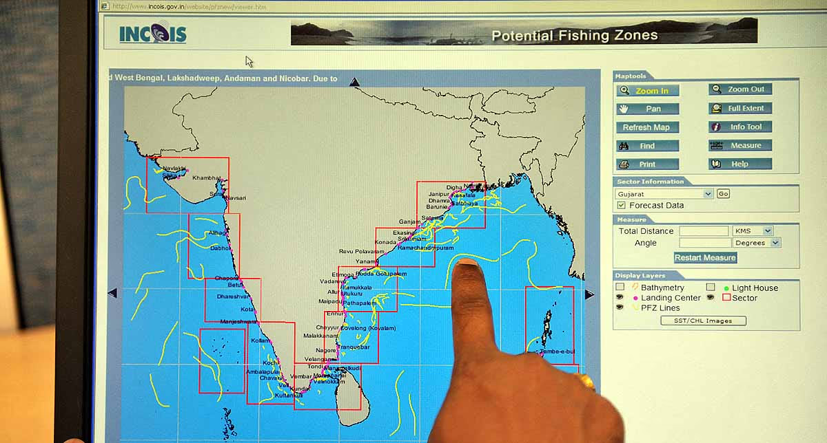
India, with its 7500 KM long coastline bordered by the Arabian Sea and the Bay of Bengal, is also home to earthquake-prone areas like the Himalayas. The 2004 earthquake near Indonesia, leading to a tsunami, heavily impacted India's coastal regions.
Back then, we lacked an effective warning system, but subsequently, the government resolved to reinforce our preparedness. Thus, the Indian National Centre for Ocean Information Services (INCOIS) crafted a robust system, which today significantly aids in safeguarding the nation.
Source: aajtak
How Does This System Operate?
India's warning system operates with remarkable intelligence, integrating multiple departments and technologies. Let's explore its core components...
Detecting Earthquakes
A nationwide network, including seismic stations of the Indian Meteorological Department (IMD), continuously monitors seismic activities.
Significant earthquakes, especially those under the sea with a magnitude of 6.5 or greater, are detected within 10-12 minutes, focusing on regions prone to tsunamis like Andaman-Sumatra and Makran.
Monitoring Ocean Depth
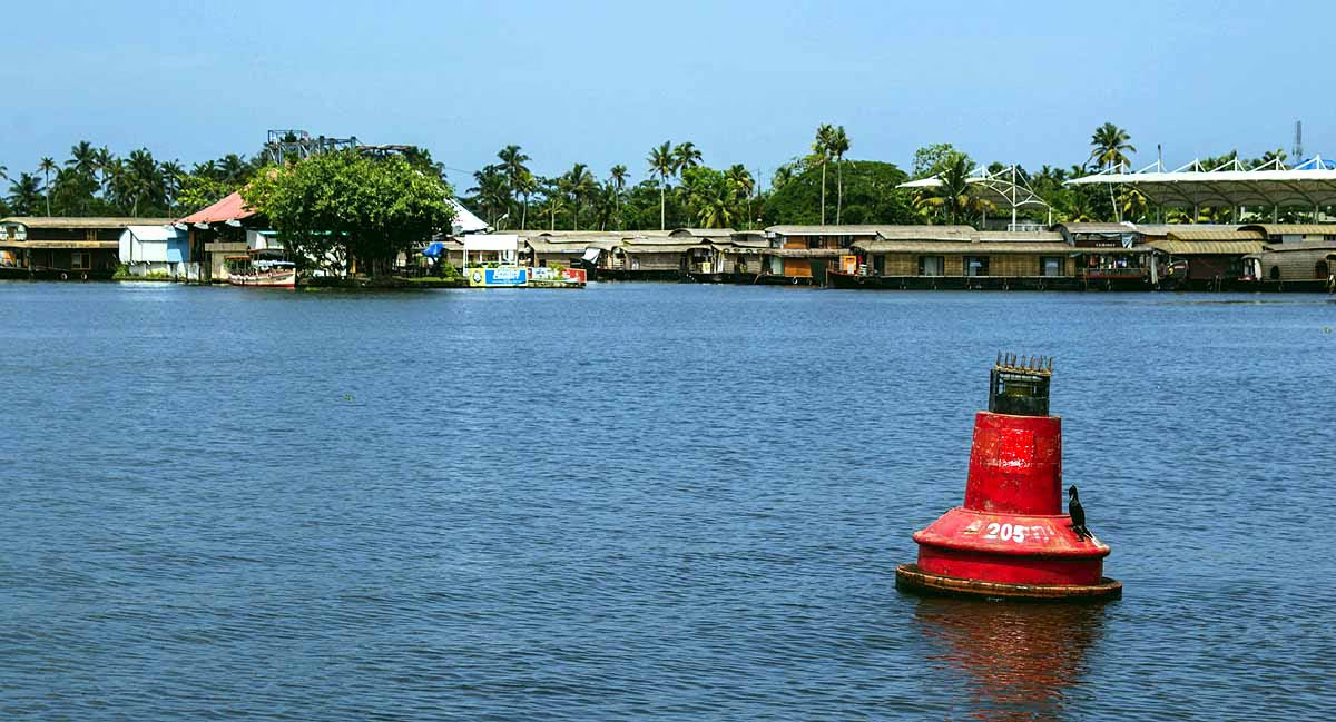
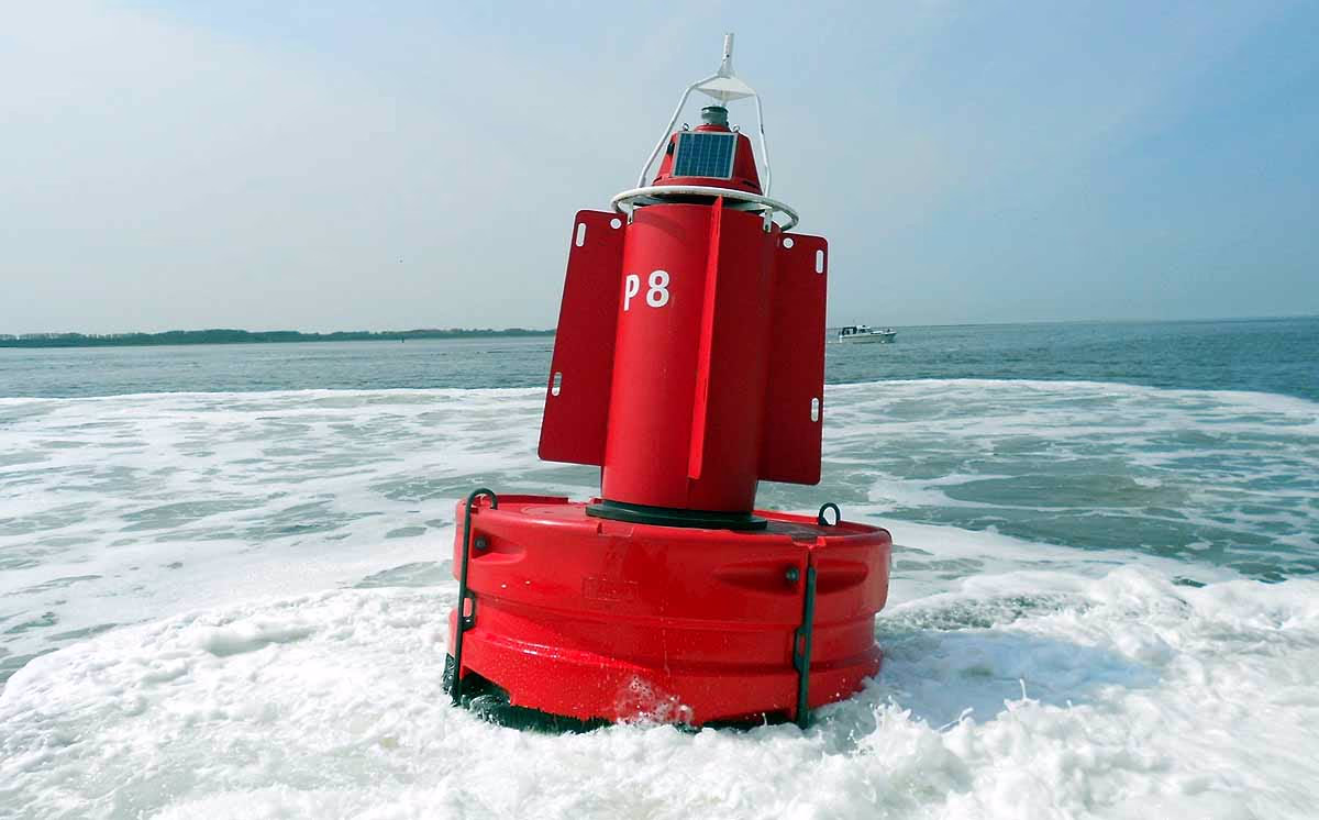
Twelve Bottom Pressure Recorders (BPR) are installed in the ocean, including four in the Bay of Bengal and two in the Arabian Sea, capable of measuring pressure changes to an accuracy of 1 centimeter, indicating tsunami onset.
In addition, 30 Tide Gauges are mounted in coastal regions to track the speed and height of tsunami waves.
Source: aajtak
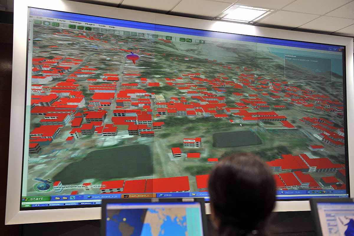
Warning Center
The INCOIS operates a 24/7 Tsunami Warning Center in Hyderabad. This center collects seismic and marine data in real-time, processed by specialized software to issue alerts if a threat is detected.
Communication System
The Indian Space Research Organization's (ISRO) INSAT satellites facilitate rapid dissemination of warnings to the Home Ministry (MHA) and state disaster management centers, which then notify coastal residents.
Timeliness of Warnings
This system issues warnings swiftly. Suppose an underwater earthquake occurs...
Step One (0-20 minutes): Earthquake information is relayed to the Home Ministry and the Ministry of Earth Sciences within 20 minutes. Alerts are also sent to nearby regions like the Andaman-Nicobar Islands.
Step Two (30 minutes): If the earthquake is greater than magnitude 6.5 and less than 100 kilometers deep, a tsunami warning is issued within 30 minutes. Areas predicted to be affected by waves within 60 minutes are promptly warned.
Step Three (Confirmation): For regions farther than 60 minutes, the warning is only issued after confirming data from BPRs and tide gauges, reducing false alarms.
For instance, if an earthquake occurs in Northern Indonesia, Andaman-Nicobar will be alerted immediately, while other regions will wait for water changes to be confirmed.
Source: aajtak
Effectiveness of This System
This system's real test came in 2007 when an 8.4 magnitude earthquake struck the Indian Ocean. Despite being only two years old then, it successfully issued timely alerts, protecting lives. During the 2012 Banda Aceh earthquake, it prevented misinformation from spreading. Today, UNESCO acknowledges India as a Regional Tsunami Service Provider for 28 Indian Ocean Rim countries, demonstrating its reliability.
Earthquake Warnings in India
India is also addressing earthquake warnings. A pilot project launched in 2021 in Uttarakhand installed 170 accelerometers to detect initial earthquake waves, capable of sending alerts 70 seconds prior. IIT Roorkee spearheads this project, complemented by a "Uttarakhand Earthquake Alert" mobile app, although still in its nascent phase.
Source: aajtak
Challenges Faced
False Alerts Risk: Quick warnings sometimes lead to false alarms in nearby areas.
Technical Constraints: Unlike earthquakes, detecting tsunamis from landslides or volcanic eruptions is still challenging.
Awareness: Many coastal inhabitants still undervalue these warnings.
Precaution and Preparedness
Upon receiving a warning, immediately move to higher ground.
Stay informed through radio, TV, or mobile alerts.
Heed advice from local disaster management teams.