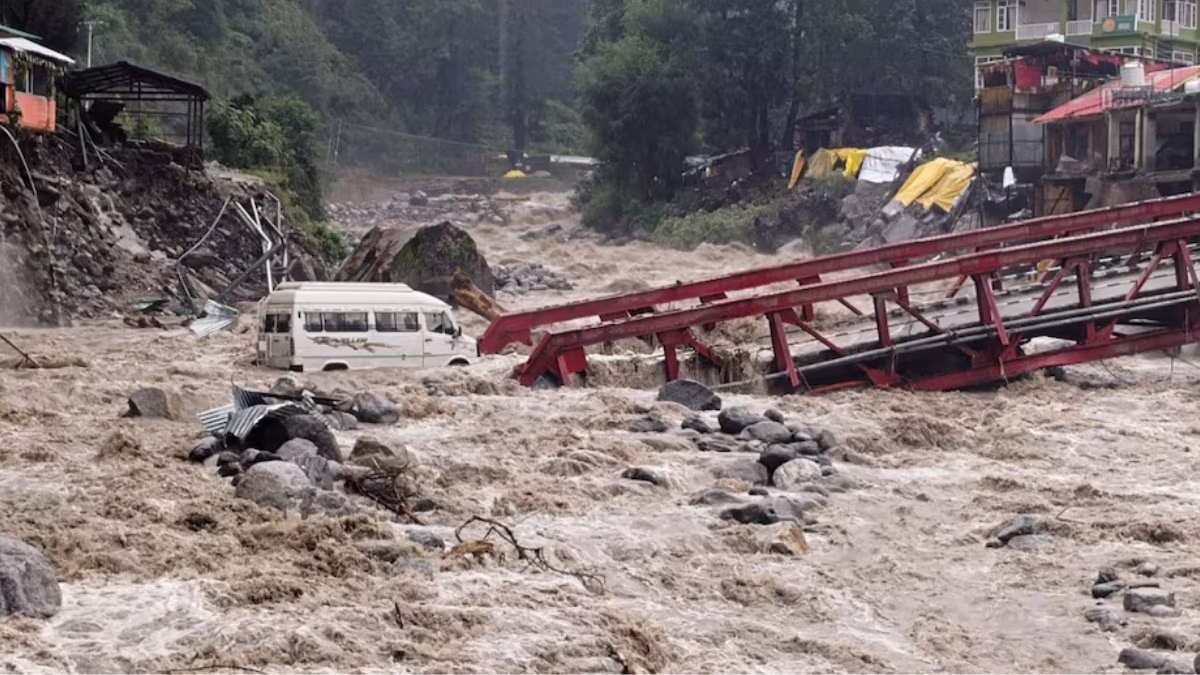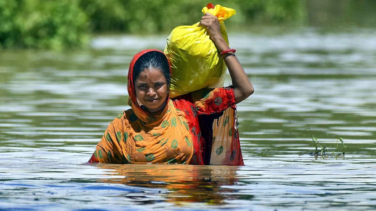
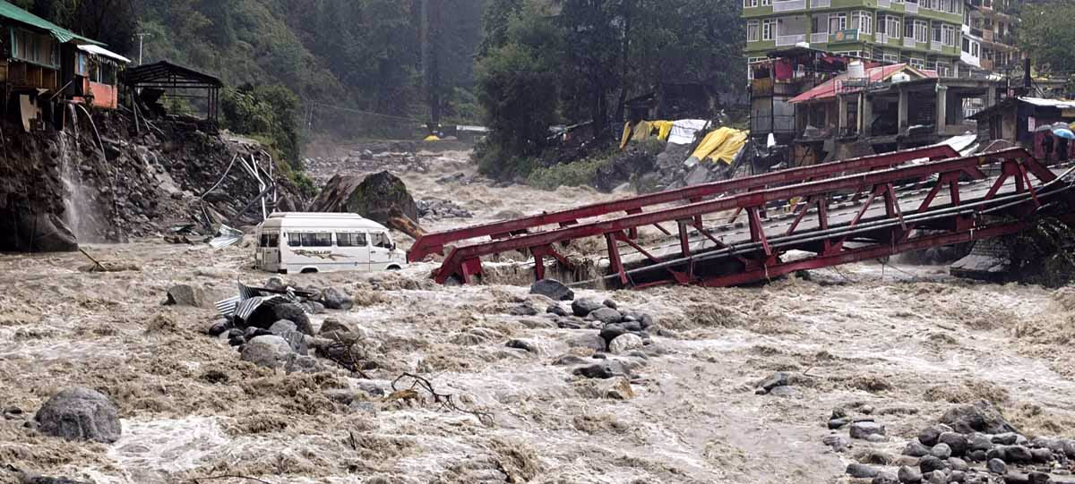
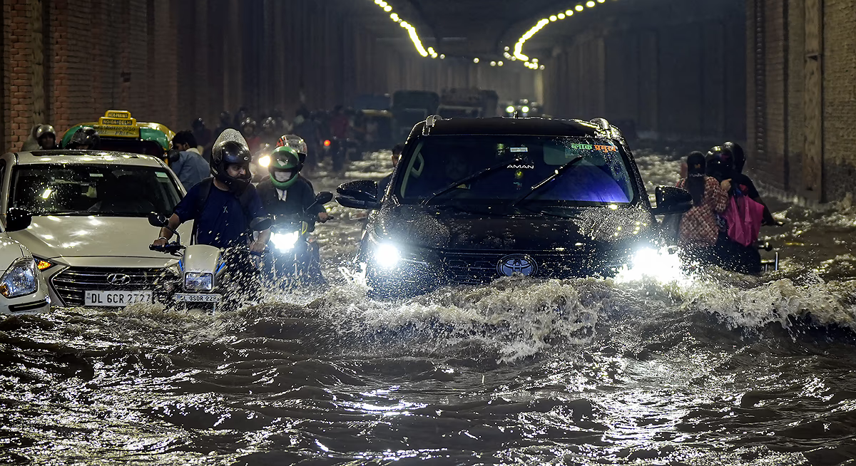
In recent days, the Himalayan states of Uttarakhand, Himachal Pradesh, and Jammu & Kashmir have been continuously suffering from natural calamities. Torrential rains, landslides, cloudbursts, and sudden floods have claimed hundreds of lives, destroyed roads and bridges, and rendered thousands homeless.
In August 2025, Northwest India experienced 265 mm of rain, the highest since 2001, breaking records. The India Meteorological Department (IMD) has issued a warning for 109% more rainfall in September 2025, increasing the risk of further destruction.
Read Also:
Source: aajtak
The Havoc of August 2025: What Happened in the Himalayan States?
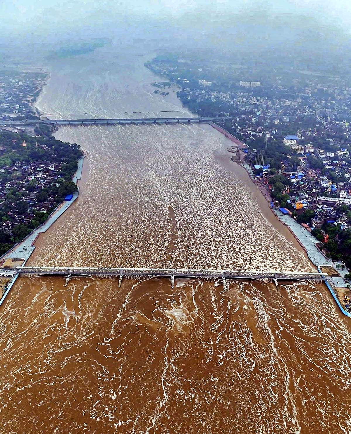
August 2025 proved to be the most destructive monsoon month. According to the IMD report, Northwest India received 265 mm of rainfall, the 13th highest since 1901. Jammu-Udhampur recorded 380 to 630 mm of rain in 24 hours, breaking a 99-year-old record.
Read Also:
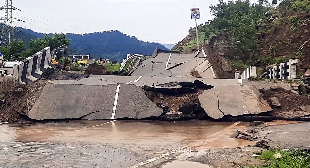
Himachal Pradesh: 320 deaths, 788 roads closed, 2174 transformers damaged. Landslides in Mandi, Kullu, Shimla closed NH-3, NH-5. Beas River in spate, Manali-Leh Highway destroyed. Total 23 flash floods, 19 cloudbursts, 16 landslides.
Uttarakhand: Flash floods in Dharali, Uttarkashi; 19 NHPC workers stranded in Pithoragarh. Red alert in Dehradun, Tehri, Nainital. 10 deaths, 75 roads closed.
Jammu & Kashmir: Over 30 deaths and 20 injuries due to landslides on the Vaishno Devi route. Tawi River bridge collapsed in Jammu with 368 mm rain. Floods in Doda and Reasi. Schools closed till September 3.
Punjab: Beas, Sutlej, Ravi rivers in spate, 3 lakh acres of crops destroyed, 7 districts flooded. Central government dispatched IMCT teams for Himachal, Uttarakhand, Punjab, and J&K.
Source: aajtak
Blame Not the Weather, But the Faulty Development
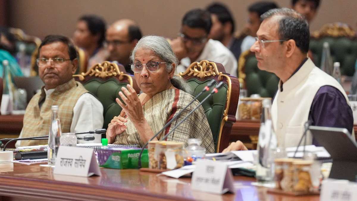
Anand Sharma, President of the Indian Meteorological Society and former IMD officer, in conversation with Rajesh Dobriyal, mentioned that while weather forecasting is improving, the major problem lies in not responding to warnings.
Challenges in the Warning System:
Alerts for well-defined systems (like cyclones) are possible 2-4 days in advance, but mesoscale systems (10-100 km) can form clouds 15 km high and cause torrential rain in an hour. Radar-satellite detection provides only 10-15 minutes warning. If activities occur at night, communication difficulties arise with mobiles off, network fails, radio-TV off.
Read Also:
Solutions:
All-weather communication systems, ham radio to community radio, and local training. Rains from flash flood catchment areas (20-50 km above) like Dharali-Chishoti reach due to lack of radar/AWS. The complex geography of the Himalayas demands more radars-AWS. Analyzing 100-year data, focus on catchment patterns.
Source: aajtak
Flawed Development Model:
Encroachments on rivers-torrents, lack of tree planting. Adopt Japan's forest belts. Planning should align with nature - build houses away from riverbanks. The British checked solid rock formations for bylaws, keeping rail-roads secure. The current Dehradun-Maldevta road built through a river might crumble. Roads along Beas in Kullu, Rispana River altered. Assembly-University near rivers.
Climate Change:
Glacier melt causing floods, but real reason is land use change. Flash floods are a mountain feature, essential for floodplain cleansing. For the Sustainable Development 2030 target, planning needs to be correct. Don't blame the weather, be aware – plan according to warnings, stay away from rivers. Without good governance, the environment won't survive.
Source: aajtak
IMD's September 2025 Forecast: More Heavy Rainfall, Risks Increase
On August 31, 2025, IMD Director General Dr. Mrutyunjay Mahapatra predicted over 109% more rain in September (LPA 167.9 mm). So far since June, 743.1 mm (6.1% above average) received.
Regionally: Northwest 26.7% more, Central 8.6%, South 9.3%. East-Northeast 17.8% less.
Risks: Landslides-flash floods in Uttarakhand; floods in Delhi-South Haryana-North Rajasthan. Mahanadi catchment in Chhattisgarh affected.
Mini cloudbursts (50 mm/hr) increasing, forecasts impossible.
Temperature: Day normal/lower (Northwest, West-Central, South), higher (East, Northeast, Western coast). Night mostly higher.
Reasons: Since 1980, September rainfall increased, withdrawal shifted from 1 to 17 September. Western disturbances-monsoon clash. ENSO neutral, La Niña possible.
Pros-Cons: Benefits to agriculture-reservoirs, yet floods, landslides, health crises. Infrastructure strengthening, early warning systems, and ecological conservation essential.
August's devastation (320+ deaths in Himachal) and September's forecast highlight how development errors along with climate change are amplifying disasters.