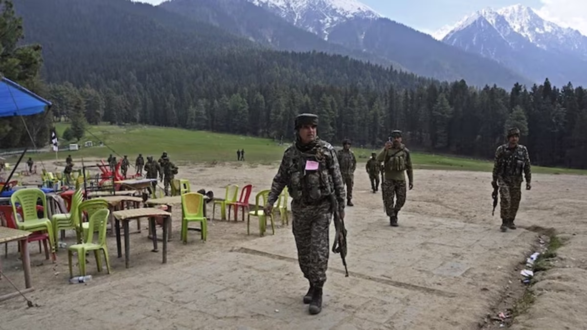
A massive search operation is underway in the dense forests of South Kashmir to track down the terrorists responsible for the brutal killing of 26 people in Pahalgam on April 22. In these 11 days, security forces have found traces of their presence in some areas, but the assailants remain elusive. Why the delay in capturing these terrorists? The answer lies in the treacherous terrain of South Kashmir. Let's understand the challenges through images...
India Today's Open Source Intelligence (OSINT) team utilized digital elevation models to explore South Kashmir's topography and discovered dense woodland and steep mountains. This type of terrain acts as a natural camouflage for the terrorists, making it difficult for security forces to chase them down, necessitating extensive search operations.
Also Read: Is a direct strike on the Pakistani Army-ISI imminent? What's India's plan post-Pahalgam attack?
Source: aajtak
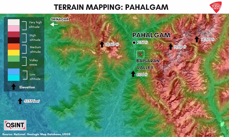
According to the US Geological Survey (USGS), the highest mountain near Pahalgam is about half the height of Mount Everest and is only a few kilometers from Baisaran. With peaks reaching 15,108 feet, this mountain forms a labyrinth of rugged mountain ranges and dense eastern forests where terrorists might be hiding.
Baisaran Meadow, known for its lush greenery amid the mountains, is located southeast of Pahalgam city. The meandering roads leading there pass through rivers, dense forests, and muddy areas, mostly impassable for vehicles. As one proceeds east, mountain ranges rise rapidly from 8,104 to 14,393 feet, further complicating the difficult terrain. Security forces are conducting extensive combing and cordon operations to locate the fugitives in these hostile terrains.
The terrorists have exploited the geographical layout to their advantage, using the dense forests stretching from Kathua in Jammu to South Kashmir as safe corridors for moving and hiding. The harsh weather in these mountainous woods adds to the challenges, with temperatures dropping rapidly at night.
Also Read: After the Pahalgam attack, PM Modi's army has a green light. Learn how India plans to strike Pakistan.
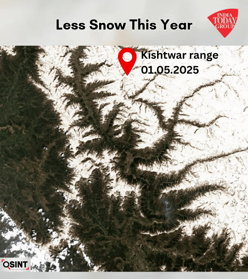
Another challenge is the Kishtwar Range, connecting to the high peaks of Pahalgam, where this season witnessed less snowfall. Due to the lack of snow, vast portions of rugged terrain remain exposed, expanding the area security forces must search. The Kishtwar Range provides a route towards Jammu, where dense forests and challenging terrain aid in the escape. While they have utilized this corridor for movement, sources believe they still remain in South Kashmir.
Source: aajtak
Coniferous trees cover this region's peaks, reaching heights of 100 to 328 feet. Towards Kashmir, Himalayan pine and spruce trees grow up to 190 feet. Towards Jammu, oak trees reach heights of up to 80 feet. These forests maintain their greenery throughout the year, with tree spacing of only 10 to 20 meters. The dense woods and underbrush limit visibility drastically—normally 30 to 35 meters and in some regions, less than 10 meters.
Also Read: After the Pahalgam attack, PM Modi's army has a green light. Learn how India plans to strike Pakistan.
Indian security officials believe that the terrorists who orchestrated the carnage in Pahalgam are well-trained for such geographical conditions and have tactical warfare training. It is believed that one of the terrorists, Hashim Musa, is a former Pakistani para-commando associated with Lashkar-e-Taiba, renowned for his military training and tactical expertise. Intelligence suggests that the Pahalgam terror attack was executed with meticulous planning. The terrorists infiltrated the region through the Samba-Kathua corridor two months prior.